Upper Salmon River Trail
Gallery
Quick Facts
| Difficulty | difficult |
| Trail Type | linear |
| Distance | 4.7 km |
| Estimated Time | 3 hrs |
| Surface Type | forested |
| Elevation Change | 126 meters |
| Features | river valley |
| Trail Markers | hiker signs |
| Scenery Rating | beautiful |
| Maintenance Rating | well maintained |
| Cell Reception | minimal |
| Dog Friendly | on a leash |
| Fees | yes |
Podcast
Episode 14: Swimming in Black Hole
Description
The trail starts by gently climbing along a hardwood ridge, passing by some sections of the trail that have been built with rock. Near the top of the ridge you will pass by a side trail that accesses the back of the Headquarters campground. There are some really large spruce along this section of the trail. Continue past this side trail and you will soon come to the top of a hill. A this point the trail starts a long descent down an old road.
At the bottom of the hill you will pop out of the woods between a small brick building and a cabin. From here you can access the river where you will find views of the cliffs ahead. The trail continues along the river on the far side of the small parking area by the buildings.
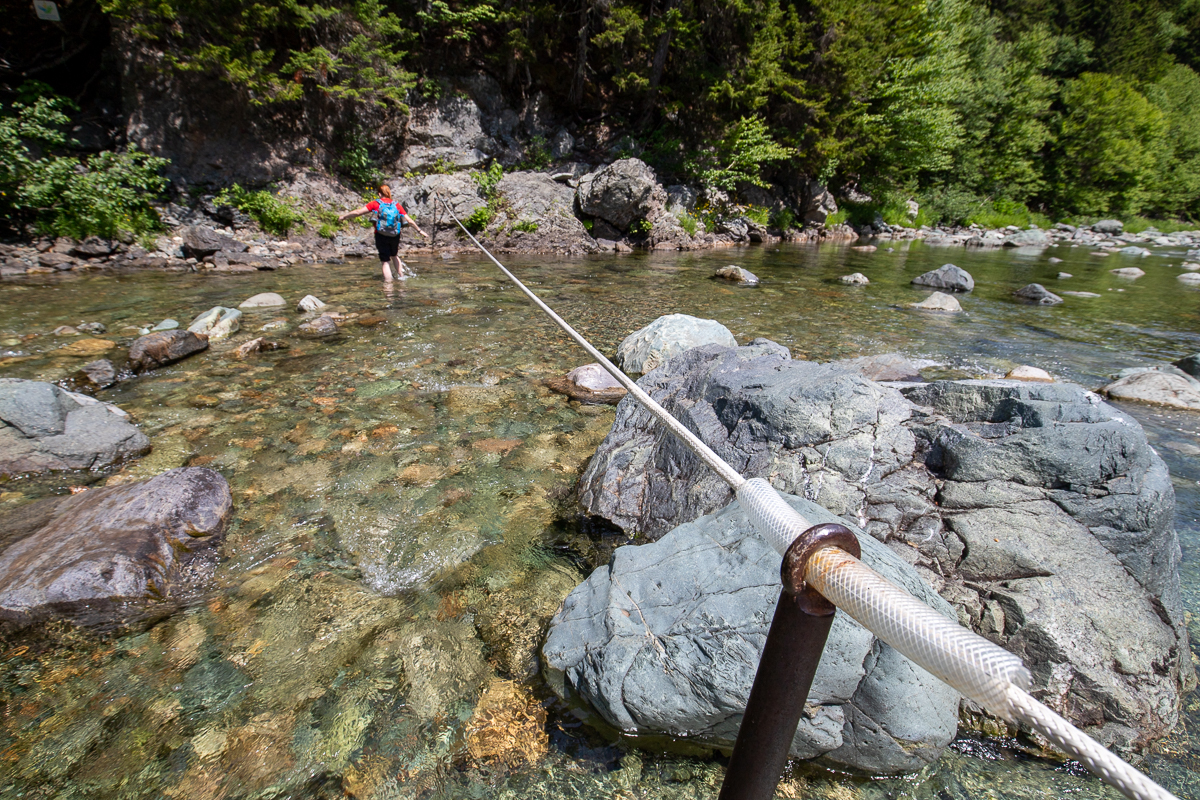
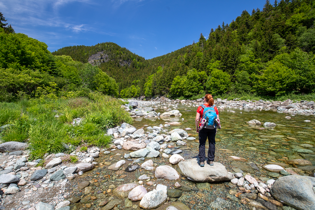
The trail travels through a mixed forest with some cool old yellow birch before reaching the river crossing. A cliff towers above the river on the far side of the river. It's best to check the water levels at the visitor centre before hiking the trial. The river crossing is usually only knee deep. Be cautious of water levels above knee deep. There is a cable across the river to help you cross. Hard soled wet shoes are a must when making these river crossings.
After the crossing the trail follows along the river. The trail passes through mainly spruce forests and passes by large boulders and small cliffs. At one place the trail travels along a narrow cliff that has a cable to hold onto. As you get further along the trail there are more open views of the river valley. At one part the trail travels along the rocky riverbed next to the river.
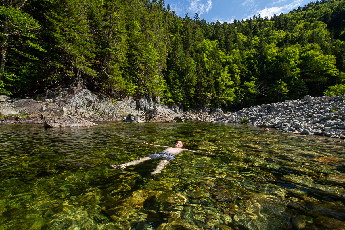
Soon the trail comes to a deep hole in the river and a sign for Black Hole. The hole used to be much bigger but gravel has since eroded from the surrounding hills and filled it in. A trail goes into the woods near Black Hole where you will find the junction with the Black Hole Trail, a ranger cabin, an outhouse and a couple of interpretive signs. This short trail ends at a lookout over the upper section of the Upper Salmon River Trail.
Continue in the river bed around the sharp bend in the river to find the upper section of this trail.
Map
Store
Directions
For directions to the park go to the Fundy National Park page.
Turn into the Headquarters Campground next to the visitor centre near Alma. Before you get to the entrance to the campground you will find a small parking lot on the left. The trail head is on the side of this parking lot.
You can also access this trail from a small access trail in the very back of the Headquarters Campground.

The other end of the trail can be accessed from the Black Hole Trail, or from the Forks Trail that joins up with the upper Section of the Upper Salmon River Trail.


Other Trails in the Park
- Bennett Brook Trail
- Black Hole Trail
- Black Horse Trail
- Caribou Plain Trail
- Coastal Trail
- Coppermine Trail
- Dobson Link
- Dickson Falls Trail
- East Branch Trail
- Foster Brook Trail
- Goose River Trail
- Herring Cove Beach
- Kinnie Brook Trail
- Laverty Falls Trail
- Marven Lake Trail
- Matthews Head Trail
- Maple Grove Trail
- Moosehorn Trail
- Point Wolfe Beach Trail
- Shiphaven Trail
- The Forks Trail
- Third Vault Falls Trail
- Tippen Lot Trail
- Tracey Lake Trail
- Whitetail Trail
From the Sign
Upper Salmon River
Follow the steps of the loggers who harvested timber here from 1825 to the establishment of the Park in 1948. The river carried millions of logs to the Alma sawmill at its mouth. Today, the woods are silent and the river is recovering from that bygone era. Remains can still be seen of old rolling dams that deepened the water in extra shallow places for the log drive. As you follow the river, stop and rest on its rocky banks and let its sounds carry you away to a different time.
Trail Last Hiked: September 18, 2021.
Page Last Updated: October 17, 2021.