Point Wolfe Beach Trail
Gallery
Store

Quick Facts
| Difficulty | easy |
| Trail Type | linear |
| Distance | 400 metres |
| Estimated Time | 15 mins |
| Surface Type | crushed rock, boardwalk |
| Elevation Change | 40 metres |
| Features | beach, point |
| Trail Markers | signs |
| Scenery Rating | must see |
| Maintenance Rating | well maintained |
| Cell Reception | not checked |
| Dog Friendly | on a leash |
| Fees | yes |
Description
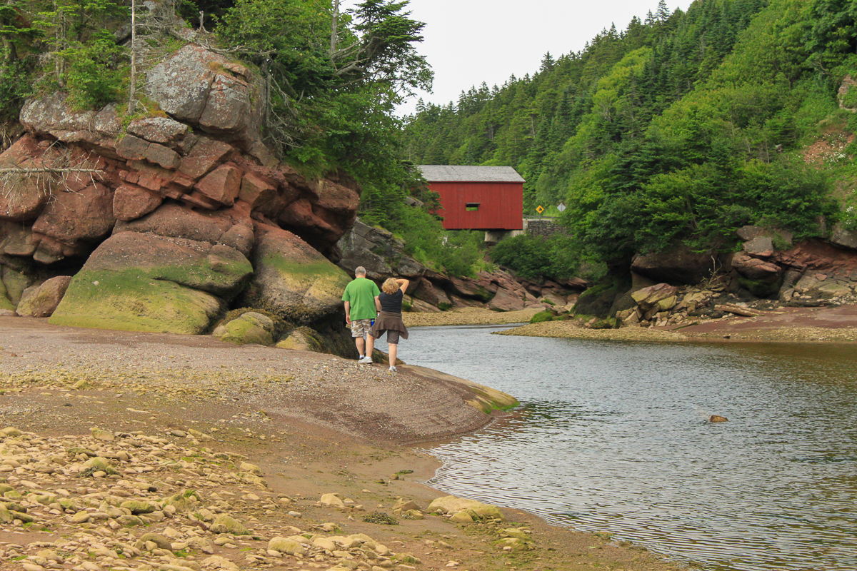
Point Wolfe Beach is one of our favorite places to explore in the park. I have walked out into the bay and been chased back by the quickly rising tides, I have layered on the rocks with Vicki and watched the eagles glide over the cliffs above, and have watched people trying to get a shot of the covered bridge through the narrow, sandstone valley at its mouth. We have explored the gravel bar and the red mud exposed by the receding tides, all while trying not to step on the thousands of snails. It is the place in the park that shows the extremeness of the tides and their impact on the rugged landscape.
The trail down to the beach from the Shiphaven Trail is a wide, gravel path (old road) that travels along the bay for a short distance before dropping down to the beach. There is a picnic table along the flat section along the bay. The trail down to the beach from the lookout platform is steeper but still moderate.
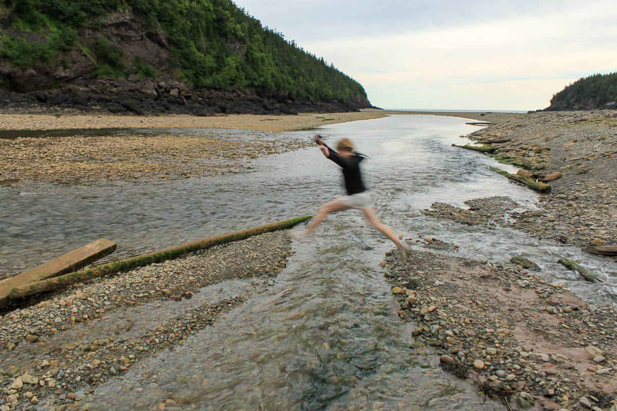
When you come out onto the beach you come out on a long sandbar that runs along this side of the long narrow bay. At low tide the bay empties out and only the narrow river remains on the far side of the bay. This opens up a large area to explore but always be aware of the Fundy tides. I had to jog to keep ahead of their return on one of my visits.
Map

From the Sign
Red Spruce
Virgin red spruce forest, home to caribou and wolves, lured loggers to this coastline in the 1800s. Most of it fell to the lumberman's axe. This is now a "second-growth" forest.
Red spruce thrive in the foggy climate of the Fundy coast, reaching a height of over 25 metres and an age of more than 300 years. They succeed on these shallow soils and rocky hillsides where few other trees can survive.
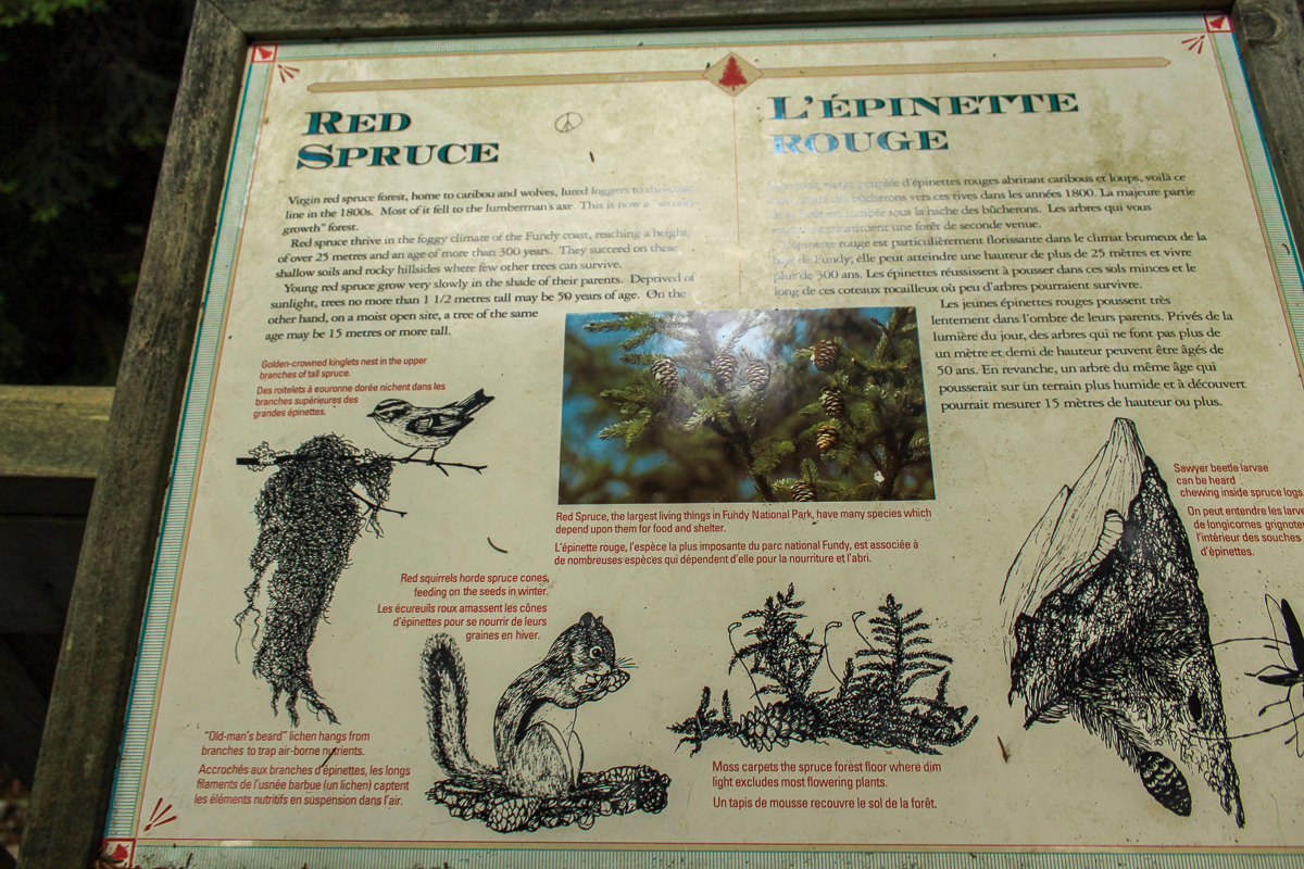
Young red spruce grow very slowly in the shade of their parents. Deprived of sunlight, trees no more than 1 1/2 metres tall may be 50 years of age. On the other hand, on a moist open site, a tree of the same age may be 15 metres or more tall.
From the Sign
Fundy's Forest Under Threat
Fog along the Fundy coast now carries harmful acids as well as life-giving moisture. Rain is at least 3 times more acidic now than before industrialization and the fog that creeps through this forest can be ten times as acidic as the rain. Automobile and industrial smokestack emissions are the most likely cause of this acidity.
Fundy's red spruce have not yet shown the severe die-offs reported in some nearby Appalachian forests. However, the leaves of our coastal white birch often turn brown in mid-summer and fall prematurely.
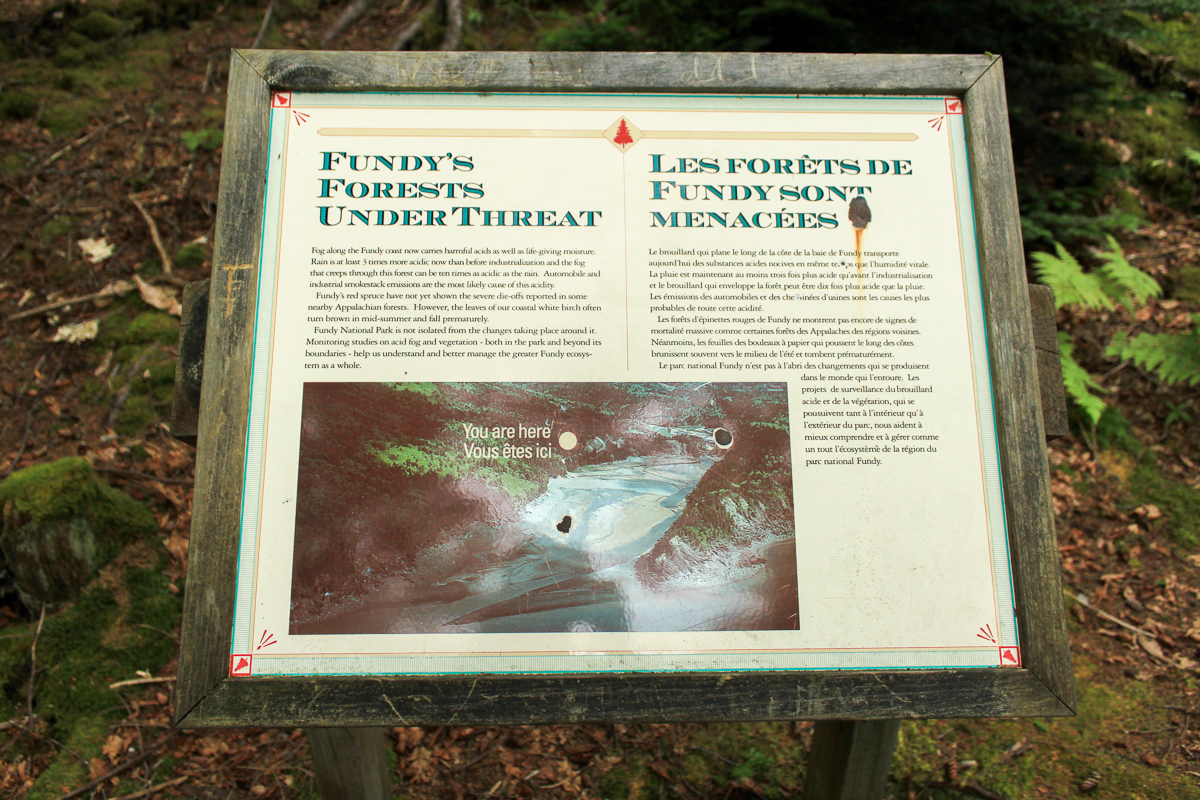
Fundy National Park is not isolated from the changes taking place around it. Monitoring studies on acid fog and vegetation - both in the park and beyond its boundaries - help us understand and better manage the greater Fundy Ecosystem as a whole.
From the Sign
A View to the World
Fundy National Park is connected to the world
This lookout is a window to the world. The Point Wolfe River empties into the Bay of Fundy, which connects it to the Atlantic Ocean and the rest of the world.
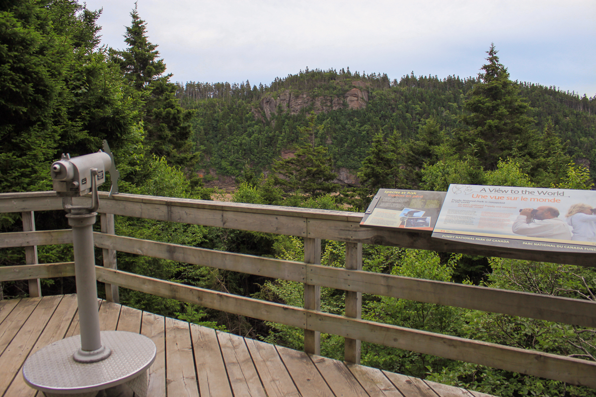
There are no fences around the park - it is connected to the world by air, land, water and species that move across boundaries. It's also connected to you! We hope you will remember our time at Fundy National Park and that you'll tell someone else whatyou experienced here.
Other Trails in the Park
- Bennett Brook Trail
- Black Hole Trail
- Black Horse Trail
- Caribou Plain Trail
- Coastal Trail
- Coppermine Trail
- Dobson Link
- Dickson Falls Trail
- East Branch Trail
- Foster Brook Trail
- Goose River Trail
- Herring Cove Beach
- Kinnie Brook Trail
- Laverty Falls Trail
- Marven Lake Trail
- Matthews Head Trail
- Maple Grove Trail
- Moosehorn Trail
- Shiphaven Trail
- The Forks Trail
- Third Vault Falls Trail
- Tippen Lot Trail
- Tracey Lake Trail
- Upper Salmon River Trail
- Whitetail Trail
Directions
For directions to the park go to the Fundy National Park page.
From the visitor centre near Alma, take the Point Wolfe Road. Drive for 7.5 kilometres and you will come to the famous red covered bridge. Continue for another 500 metres and turn left into the Point Wolfe parking lot. At the far end of the parking lot on the right you will find a short trail out to the lookout platform. From the lookout platform you can take a steep trail down to the beach.
For a more gentle slope down to the beach take the Shiphaven Trail on the left of the parking lot. After a short distance turn right on an old road. This old road will take you down to the beach.
Trail Last Hiked: July 15, 2011.
Page Last Updated: January 3, 2023.