Dickson Falls Trail
Gallery
Store
Quick Facts
| Difficulty | moderate |
| Trail Type | loop |
| Distance | 1.4 km total |
| Estimated Time | 30 mins |
| Surface Type | crushed rock, boardwalk |
| Elevation Change | 79 metres |
| Features | waterfall, gorge |
| Trail Markers | signs |
| Scenery Rating | must see |
| Maintenance Rating | well maintained |
| Cell Reception | not checked |
| Dog Friendly | on a leash |
| Fees | yes |
Description
The trail starts at a large lookout platform that provides a beautiful view of the Bay of Fundy coastline. The lookout platform has many interpretive signs describing the environment, landscape, plants and animals in this area (see gallery). The trail then descends from the lookout platform and into the woods.

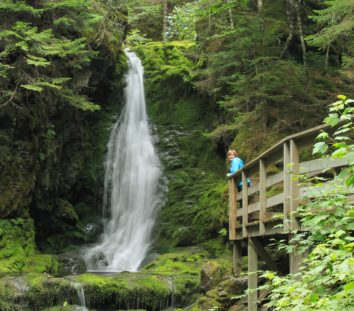
The trail is the most popular in the park because its a short hike to a beautiful waterfall. The trail is two loops that come together at the falls. The trail is mostly wide and crushed rock. A boardwalk takes you up through the deep, mossy valley below the falls. The centre trail that overlaps both loops takes you along the stream above the falls. The rest of the trail loops through a mixed wood forest. On our visit we got to see a partridge in a spruce tree just as we were finishing one of the loops.

Dickson Falls is 9 metres (26 feet) high and tumbles over a mossy rock face. A lookout platform juts out into the valley just below the falls giving an optimal view of the falls. The stream then tumbles down through the steep sided valley on its way to the Bay of Fundy.
Map

Other Trails in the Park
- Bennett Brook Trail
- Black Hole Trail
- Black Horse Trail
- Caribou Plain Trail
- Coastal Trail
- Coppermine Trail
- Dobson Link
- East Branch Trail
- Foster Brook Trail
- Goose River Trail
- Herring Cove Beach
- Kinnie Brook Trail
- Laverty Falls Trail
- Marven Lake Trail
- Matthews Head Trail
- Maple Grove Trail
- Moosehorn Trail
- Point Wolfe Beach Trail
- Shiphaven Trail
- The Forks Trail
- Third Vault Falls Trail
- Tippen Lot Trail
- Tracey Lake Trail
- Upper Salmon River Trail
- Whitetail Trail

Directions
For directions to the park go to the Fundy National Park page.
Take Point Wolfe Road from the Visitor Centre near Alma. After 2.3 kilometres you will find the parking lot for Dickson Falls on the left. Park here. The trail leaves from the lookout platform at the end of the parking lot.

Trail Last Hiked: January 2, 2017.
Page Last Updated: January 5, 2023.