Matthews Head Trail
Gallery
Store

Quick Facts
| Difficulty | moderate |
| Trail Type | loop |
| Distance | 4.7 km |
| Estimated Time | 2 hrs |
| Surface Type | field, forested |
| Elevation Change | 116 metres |
| Features | coastal views |
| Trail Markers | brown squares |
| Scenery Rating | beautiful |
| Maintenance Rating | well maintained |
| Cell Reception | none |
| Dog Friendly | on a leash |
| Fees | yes |
From the Sign
Matthews Head
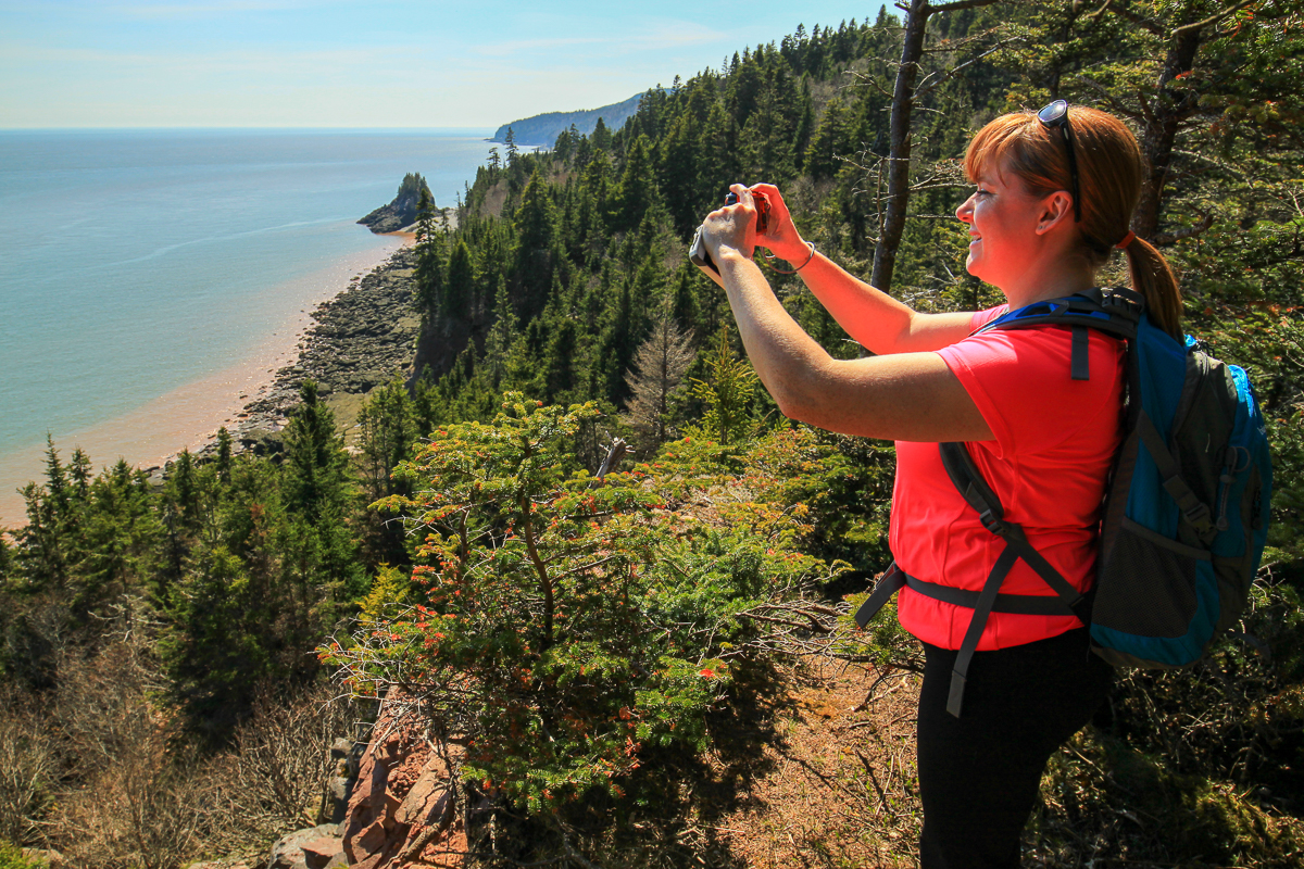
Hike along an old cart track through fields and softwoods. The trail passes by the remains of an old homestead settled by Thomas and Ellen Matthews in 1865. The stone foundations of their farm buildings crumble as alder and spruce trees reclaim the cleared fields. You will enjoy the splendid views of the Fundy coast from various points along the trail.
First section - moderate - gradual downhill to a junction with the Coastal Trail - at the junction, continue left to Matthews Head (0.3 km) or turn right to hike along the coast with spectacular views of the Bay of Fundy.

Second section - moderate - the trail follows the coastline to a lookout. Beyond the lookout, the trail swings inland with a few moderate grades and reaches a junction. This section is shared with the Coastal Trail.
Third section - moderate - turn right at the junction, the trail ascends through woods to a large field. Follow the path through the field to the parking lot.
Map

Description
The Matthews Head Trail is a large loop that first travels through a field and then drops down into a beautiful coastal spruce forest (going counter clockwise). On your way down the hill you will get glimpses of the Bay of Fundy before coming to a junction with the western section of the Coastal Trail. Turn left to continue on the loop.
The next section of the trail follows the coast and continues through more beautiful spruce forest. There are several lookouts along the way that provide amazing coastal views. The first set of lookouts looks down the coast to the west, towards a small, tree-topped island just offshore. Use caution around these lookouts. A few of them are quite exposed.

Continue along the coast and you will pass a couple more lookouts before coming to the junction at the other side of the loop. Turn right at this junction to go down to Matthews Head (300 metres), or turn left and you will start your slow climb back up the hill. The trail passes through an old field where you will find the remnants of an old homestead. Continue to climb on the old road and you will eventually come out into the fields at the top of the hill. Cross the field and you will be back at the parking lot.
Directions
For directions to the park go to the Fundy National Park page.
You can access the Matthews Head Trail from Herring Cove Road. From the Visitor Centre near Alma, take the Point Wolfe Road. After 6.1 kilometres you will come to the Herring Cove Road on the left. Turn onto Herring Cove Road. After 1.7 kilometres you will see a road into a parking area on the right. Park in this parking lot. The trail is on the right near the entrance to the parking lot.

Part of the Matthews Head loop overlaps part of the western section of the Coastal Trail. You can access this section of the Coastal Trail from the parking lot at the end of the Herring Cove Road, or from the parking area near the covered bridge near Point Wolfe.

Other Trails in the Park
- Bennett Brook Trail
- Black Hole Trail
- Black Horse Trail
- Caribou Plain Trail
- Coastal Trail
- Coppermine Trail
- Dobson Link
- Dickson Falls Trail
- East Branch Trail
- Foster Brook Trail
- Goose River Trail
- Herring Cove Beach
- Kinnie Brook Trail
- Laverty Falls Trail
- Marven Lake Trail
- Maple Grove Trail
- Moosehorn Trail
- Point Wolfe Beach Trail
- Shiphaven Trail
- The Forks Trail
- Third Vault Falls Trail
- Tippen Lot Trail
- Tracey Lake Trail
- Upper Salmon River Trail
- Whitetail Trail
Trail Last Hiked: May 16, 2015.
Page Last Updated: December 25, 2022.