Kinnie Brook Trail
Gallery
Store

Quick Facts
| Difficulty | moderate |
| Trail Type | linear |
| Distance | 1.4 km one way |
| Estimated Time | 1 hr return |
| Surface Type | crushed rock |
| Elevation Change | 86 metres |
| Features | rocky outcrops, gorge |
| Trail Markers | signs |
| Scenery Rating | must see |
| Maintenance Rating | well maintained |
| Cell Reception | not checked |
| Dog Friendly | on a leash |
| Fees | yes |
Description
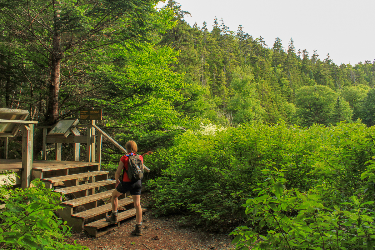
The Kinnie Brook Trail is a short but surprisingly interesting trail. At 750 meters the trail branches off to the right to access the Chignecto Campground. Continue left for another 350 meters and the trail starts to get interesting. The first small set of stairs takes you down to a boardwalk through a small valley that has rock slides along the sides and is full of Rhododendron. Another small set of stairs at the end of the small boardwalk takes you up and out of this unique little valley.

Shortly after the stairs you will come to the larger set of stairs that take you into the much deeper valley that holds Kinnie Brook. As you start down the long set of stairs you will notice the large rock spire on your right. Continue down the stairs and you will come to a small platform at the valley bottom. The platform has many interpretive signs described below. They outline the geology of the area and a bit about how Kinnie Brook is a dry stream that runs underground for part of the year. Step off the platform and you can explore the streambed that is full of bare rock and gravel. We are planning to return some time when the water is flowing above ground to see the comparison. This trail shows some of the very interesting geology that Fundy National Park has to offer.

The trail is quite flat for the first kilometer with a few small ups and downs. The long set of stairs is the only difficult part of this trail.
Map

From the Sign
Riverwater and Time
This narrow valley with its stony spires and gorge attests to the erosive force that the now-tiny brook has been able to exert over time. Beneath your feet and all around you is diorite, a granite-like rock. It originated far underground as moten material, was squeezed up through cracks in the earth's crust, and solidified beneath the cool surface. Millions of years ago, erosion exposed the diorite to weathering and deep channels such as the valley were cut by running water - truly a master-carver of stone.

From the Sign
Welcome to Kinnie Brook Trail
this short walk (2.4 km return) will lead you through forest rejuvenated by the spruce budworm, along the edge of a deeply eroded plateau, past cliffs and rock pinnacles, and down wooden stairs into a hidden valley. There, in a lush ferny floodplain, the continually-flowing waters of Kinnie Brook sometimes vanish underground - the old disappearing-brook trick!
Along the trail, thickets of maple, birch, fir, and spruce have sprung up to replace budworm-killed red spruce and balsam fir. If you are quiet, you might see some of the deer, moose, and hare that browse this feast of young trees.

From the Sign
This is Kinnie Brook
In front of you is either a swift clear brook or a dry bouldery riverbed. Like most of Fundy's valleys, Kinnie Brook was buried under stone rubble during the last ice age. The brook has washed itself clear of most of this sediment, but the floor of the valley is still filled with loosely-packed rocks. In dry summers the brook flows completely underground through this stony sieve. During spring runoff and after heavy rains, Kinnie Brook floods the valley and pours through the gorge downstream.
If you explore up and down stream you will either find places where the water vanishes and reappears, or you will get wet feet - depending on the condition of this now-you-see-it-now-you-don't brook.

From the Sign
Life at the Water's Edge
Here the trail ends and the floodplain begins. Five-minutes' walk upstream is The "strainer", where Kinnie Brook sometimes sinks into the gravel. You can explore this floodplain by following the streambed and the narrow paths that wind through thickets of red oster dogwood, over fragrant patches of mint, and past pools quick with trout and river insects.
Ostrich ferns thrive in the rich moist soil; their tightly-curled leaves, called fiddleheads, unfurl in Spring into tall lacy fronds. Growing nearby, cow parsnip - with its giant pungeant leaves - dwarfs even the ferns.

Please remember, valley-bottom plants are adapted to periodic flooding but do not recover well from trampling or picking. Happy explorations!
Directions
For directions to the park go to the Fundy National Park page.
From the park entrance at Alma continue north-west on highway 114. Climb the big long hill and pass the Chignecto Campground. At 5.2 km you should see a small parking lot on your right. The Kinnie Brook Trail starts just inside this parking lot straight ahead.
From the northern park entrance at Wolfe Lake continue south-east on highway 114. Continue past Bennett Lake and the Laverty Auto Trail. At 14.8 km you should see a small parking lot on your left. The Kinnie Brook Trail starts just inside this parking lot straight ahead.
The Kinnie Brook Trail can also be accessed from the north-west corner of the Chignecto Campground.
Other Trails in the Park
- Bennett Brook Trail
- Black Hole Trail
- Black Horse Trail
- Caribou Plain Trail
- Coastal Trail
- Coppermine Trail
- Dobson Link
- Dickson Falls Trail
- East Branch Trail
- Foster Brook Trail
- Goose River Trail
- Herring Cove Beach
- Laverty Falls Trail
- Marven Lake Trail
- Matthews Head Trail
- Maple Grove Trail
- Moosehorn Trail
- Point Wolfe Beach Trail
- Shiphaven Trail
- The Forks Trail
- Third Vault Falls Trail
- Tippen Lot Trail
- Tracey Lake Trail
- Upper Salmon River Trail
- Whitetail Trail
Trail Last Hiked: July 16, 2011.
Page Last Updated: January 5, 2023.