Net Point Trail
Gallery

Store

Quick Facts
| Difficulty | easy |
| Trail Type | linear |
| Distance | 800 metres one way |
| Estimated Time | 25 mins |
| Surface Type | forested |
| Elevation Change | 11 meters |
| Features | coastal views, lighthouse |
| Trail Markers | Red Markers |
| Scenery Rating | beautiful |
| Maintenance Rating | well maintained |
| Cell Reception | strong |
| Dog Friendly | yes |
| Fees | none |
Directions
When you come off the ferry on Grand Manan and come to the junction turn right onto Pettes Cove Road. After 270 meters you will come to the beach at Pettes Cove where the road takes a sharp turn to the left. At the turn there is a small parking area for the beach on your right. The Net Point Trail starts on the right hand side of the beach.

The trail can also be accessed from beside the tank farm across from the Ferry Terminal but there is a sign indicating that access is prohibited from this side of the point. This section of the trail crosses private property so please follow the advice on the sign and access the trail from the Pettes Cove side of the point.
Map

Description
The Net Point Trail is a short trail that follows the rugged coastline. The trail provides many views of Pettes Cove and the Swallowtail Lighthouse. There are also several different types of rock formations along the trail that are interesting. Near the start of the trail there are several access trails to the beach below. The trail crosses in front of several houses. Soon the coastline becomes more rugged and the side trails access lookouts to the ocean and the rocks below.
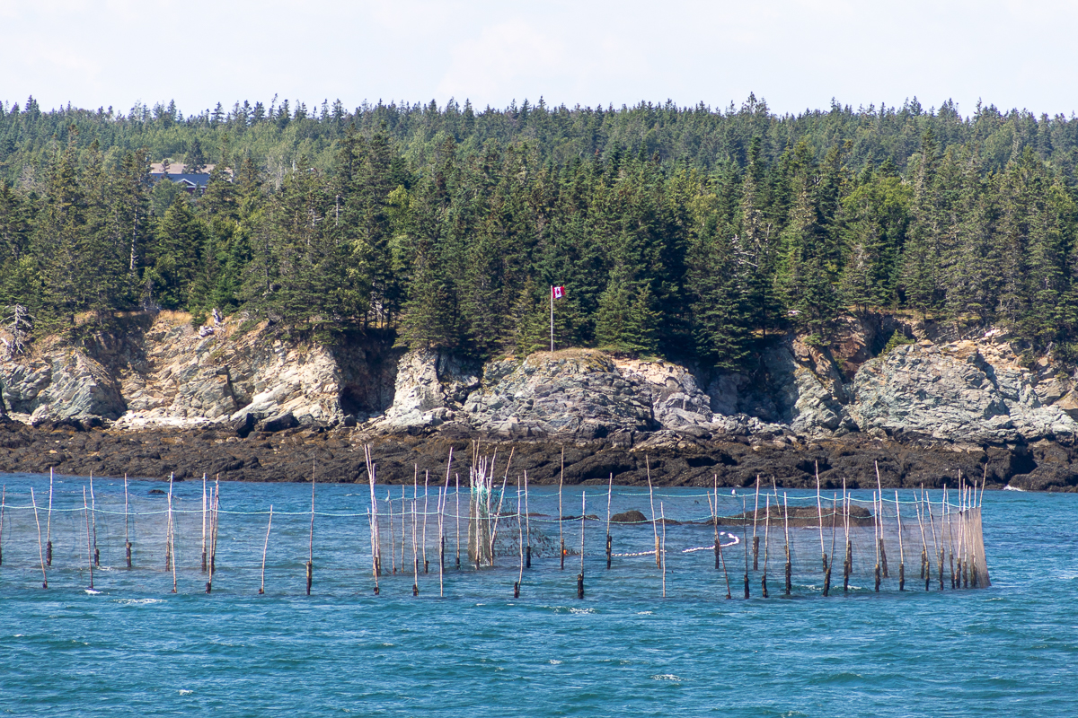
Near the southern end of Net Point the trail weaves in and out of the forest providing intermittent views of the weir poles that hold fishing nets. It is common to see cormorants looking for a meal or just enjoying the sun. Look south and you will see the eastern coast of Grand Manan. The trail will eventually come to a small field with the ferry terminal tank farm on the other side. This is the end of the trail and where you get to turn around and enjoy it all over again.
Trail Last Hiked: March 31, 2012.
Page Last Updated: August 1, 2021.