Sussex Bluffs Trail
Video
Quick Facts
| Difficulty | moderate |
| Trail Type | linear |
| Distance | 2 km one way |
| Estimated Time | 1 hour |
| Surface Type | forested, rocky |
| Elevation Change | 90 meters |
| Features | views |
| Trail Markers | red blazes |
| Scenery Rating | must see |
| Maintenance Rating | well maintained |
| Cell Reception | strong |
| Dog Friendly | yes |
| Fees | none |
Gallery

Description
Note: Please refrain from lighting campfires on the Bluffs Trails. Fires are not permitted. This trail is on private land so please respect the landowners' wishes for continued access to this beautiful trail.
The Bluffs trail starts as a steady climb along a wooded ridge. On the way to the top there are several openings that provide views of Dutch Valley below. The trail starts in a mixedwood forest that gradually turns into softwood. Near the top it is mainly red pine. Some of the red pine here are stunted and make interesting shapes. The trees get thinner until you come out to the opening on the first bluff. The bluff is on a rounded peak with views of the farms and fields in Dutch Valley. From here you can also see Poley Mountain Ski Hill in the distance.

From the first bluff the trail goes back in along the trees on the way to the second larger bluff. There are no trees on this longer ridge where there are unfettered views up and down Dutch Valley. The trail continues along the bluffs then drops down into a small wooded valley. The trail continues past this point but we haven't yet explored how far it can still be followed.
Caution is required on this trail. Stay back from cliff edges and do not leave the trail. Although the drop-off is rounded it gets increasingly steep down the slope with nothing to grab onto. The trail itself is made of a loose sandstone material that can be slippery.
The Bluffs Trail is on private land so please tread lightly so everyone can enjoy the trail for years to come.
The trail to the Bluffs was the beginning of the Catamount Trail. The Catamount Trail used to go all the way to the Fundy Coast where it met up with the Fundy Footpath. Unfortunately the Catamount Trail has not been maintained. Remnants of the Catamount Trail can be found following Quiddy River on the way to Wallace Falls to the south of Sussex.
Map
Store
Directions
From Sussex Corner take route 111 (Post Road) north-east towards Moncton. Continue past Sullivan Park and some fields, and after 1 km turn right onto Sullivan Street. After two 90 degree turns the street turns into Rockbridge Drive and starts to climb the hill. After 300 meters from the last turn you will come to a small wide area and a gate. The gate has a no trespassing sign. The reason for the no trespassing sign is to help protect the water supply for the Village of Sussex Corner. Vehicles parking at the water tower pose a risk to the water supply. Please respect this sensitive area and park at the cul-de-sac before the no trespassing sign.
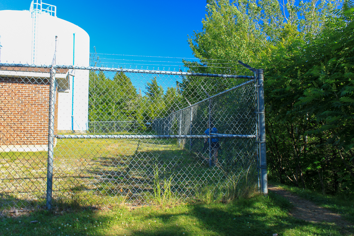
Past the gate walk up the road for another 600 meters until you come to the water tower. Once at the water tower follow the fence to the right. The trail starts off the back right corner of the fenced in area.
A more interesting way to access the bluffs trail is through Sullivan Park. From the park follow along the banks of Trout Creek. After the cropland head up over the ridge to the water tower.
Hiking times are from the water tower so add approximately 30 minutes to your time to access the tower.


Trail Last Hiked: September 8, 2018.
Page Last Updated: November 16, 2019.