Parlee Brook Amphitheatre Trail
Videos
Quick Facts
| Difficulty | moderate |
| Trail Type | linear |
| Distance | 3.0 km one way |
| Estimated Time | 2 hours |
| Surface Type | old road, forested |
| Elevation Change | 140 meters |
| Features | ice valley |
| Trail Markers | orange ribbons |
| Scenery Rating | must see |
| Maintenance Rating | well maintained |
| Cell Reception | none |
| Dog Friendly | yes |
| Fees | none |
Gallery
Description
Near the start of the Arnolds Hollow Road you will find a small house (behind a tall fence) that looks like an abbey. The abbey looks like it belongs in the Swiss Alps and not in the woods near Sussex, New Brunswick. If you look above and behind the abbey you should be able to see the rocky outcrop of Friar's Nose. The Arnolds Hollow Road is a steady climb for about 1 km. The road passes several other unique buildings in the woods behind the abbey. The road eventually comes to a clearing as the hill plateaus.
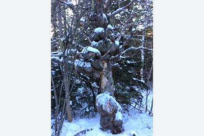
Turning left on the trail that climbs the hill will take you up to Friar's Nose. To get to the Amphitheatre continue straight. The trail starts to go down the hill into Hidden Valley. At the bottom of the hill is a small pond and soon the road comes to a camp on the left. The camp is perched below a large rocky cliff. Continue straight on the old road. This section of road follows closely along the stream in the valley bottom. When the old road climbs a bit and then flattens out you should find ribbons and the strange tree (thank you Krista Friars Edwards for the photo) marking the trail to the Amphitheatre on the left. In the winter there is usually a well beaten trail in the snow.
The trail quickly narrows in until you are following back and forth along the small stream. Small hardwoods flank the meandering stream. The stream flows over a conglomerate type rock that is indicative of the cliffs at the Bluffs in Sussex and at the nearby Friar's Nose. Rocky outcrops protrude from the hillsides as you get closer to the main valley. One rocky outcrop forms a sort of cave as it overhangs the stream.
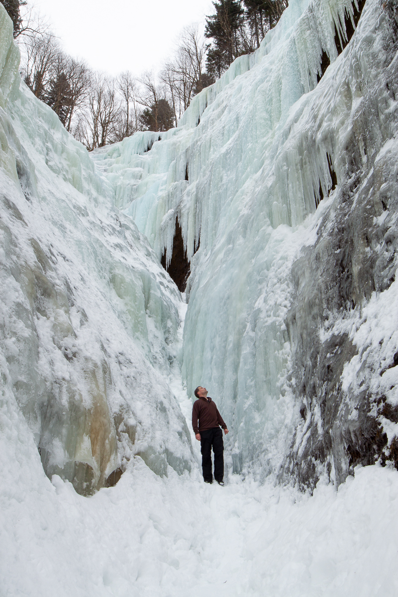
When you reach the main valley you will find steep cliffs rising up on both sides. The top of the valley is rimmed with large spruce trees. In the winter months the walls of this valley are covered in a thick layer of ice. This is when the valley is most spectacular. Ice climbers come to this valley to climb the large walls of ice. The ice has different colors on different walls adding to the beauty.
Map

Store


Directions
From Sussex Corner take Route 111 towards St. Martins. After 550 meters keep left on Waterford Road. After 5.7 km turn right onto Parlee Brook Road. After 2.5 km the road changes to gravel and at 4.9 km you will find the sign for Arnolds Hollow Road climbing the hill on the right. On the left side of the trail is a house that some call the Abbey due to its unique look. Do not park near this house. Please cross the bridge just beyond the Abbey and park on the the other side of the stream (see map below).
Update Feb. 17, 2018 - Continue past the wide area in the road to park. This is where plows turn and if you are parked there they can't turn.

Blog Post

Trail Last Hiked: February 1, 2016.
Page Last Updated: Dec. 22, 2018.