Midland Ice Caves Trail
Gallery

Store

Quick Facts
| Difficulty | moderate |
| Trail Type | linear |
| Distance | 4.8 km return |
| Estimated Time | 1 hr 45 mins |
| Surface Type | old road, forested |
| Elevation Change | 110 meters |
| Features | ice caves |
| Trail Markers | none but easy to follow |
| Scenery Rating | beautiful |
| Maintenance Rating | well maintained |
| Cell Reception | medium |
| Dog Friendly | on a leash |
| Fees | none |
Description
The trail to the ice caves follows an old road that travels along a fence line and steadily climbs through the field towards the woods. After 1 km the trail climbs a steeper section into the woods. After another 387 meters the road comes to a junction. There was previously a snowmobilers warming hut and outhouse on the corner but I have been told that these buildings no longer exist at this location. Take the trail to the left. After approximately 450 meters you will come to another junction in the trail with a sign on the tree showing that the trail on your right takes you to the ice caves. The trail starts to descend slowly towards the caves and passes several old roads. After 280 meters the trail takes a sharp turn to the left and you will soon be looking down into the small valley that holds the ice caves.
Ropes have been tied between the trees to provide help in climbing down into the valley. Once down in the valley you will be looking up at a long wall of ice. Someone usually punches a hole in the ice on the upper end of the valley so you can climb behind the ice wall and into the cave behind. The caves are formed by an overhang in the rock where water flows over to form large icicles making the wall. The ice caves are spectacular in the winter when the water is froze enough to form the walls. I am not sure what the caves look like in the summer months but I may have to find out.
Remember that the Midland Ice Caves are on private land and that it is a privilege, not a right to be allowed to visit them. Please tread lightly when visiting and make sure you don't leave anything behind. It would be tragic if they were no longer available to enjoy.
Map
Note
Due to the increased popularity of the Midland Ice Caves there have been some issues between hikers and snowmobilers. Please use the access route described below to minimize foot traffic on the snowmobile trail. On this route there are 450 meters of that still follows a main groomed snowmobile trail. On this section the snowmobiles have the right of way. Please move off the trail when you hear snowmobiles approaching and keep dogs on a leash. Thank you.
Directions
Traveling from Fredericton on Route 2 take exit 339 at Jemseg. Turn left onto Grand Lake Drive then shortly after turn left again onto Route 695 towards Cambridge Narrows. Continue on Route 695 for 34 km until you get to Springfield. You cross the bridge at Cambridge Narrows about half way. At Springfield you will come to a T in the road. Turn left onto Route 124 and after just 500 meters the road will turn sharply to the right. Continue on Route 124 for another 2.2 km then turn right onto Route 855. After another 100 meters turn right onto Guthrie Road. After 1.4 km you will come to a stop sign at a junction with Upper Midland Road. Turn right on Upper Midland Road and after 350 meters you will see a long fence line on your right. This is the start of the trail. You should be able to see the large barn for Everanne Farms on the hill in front of you (see picture below).
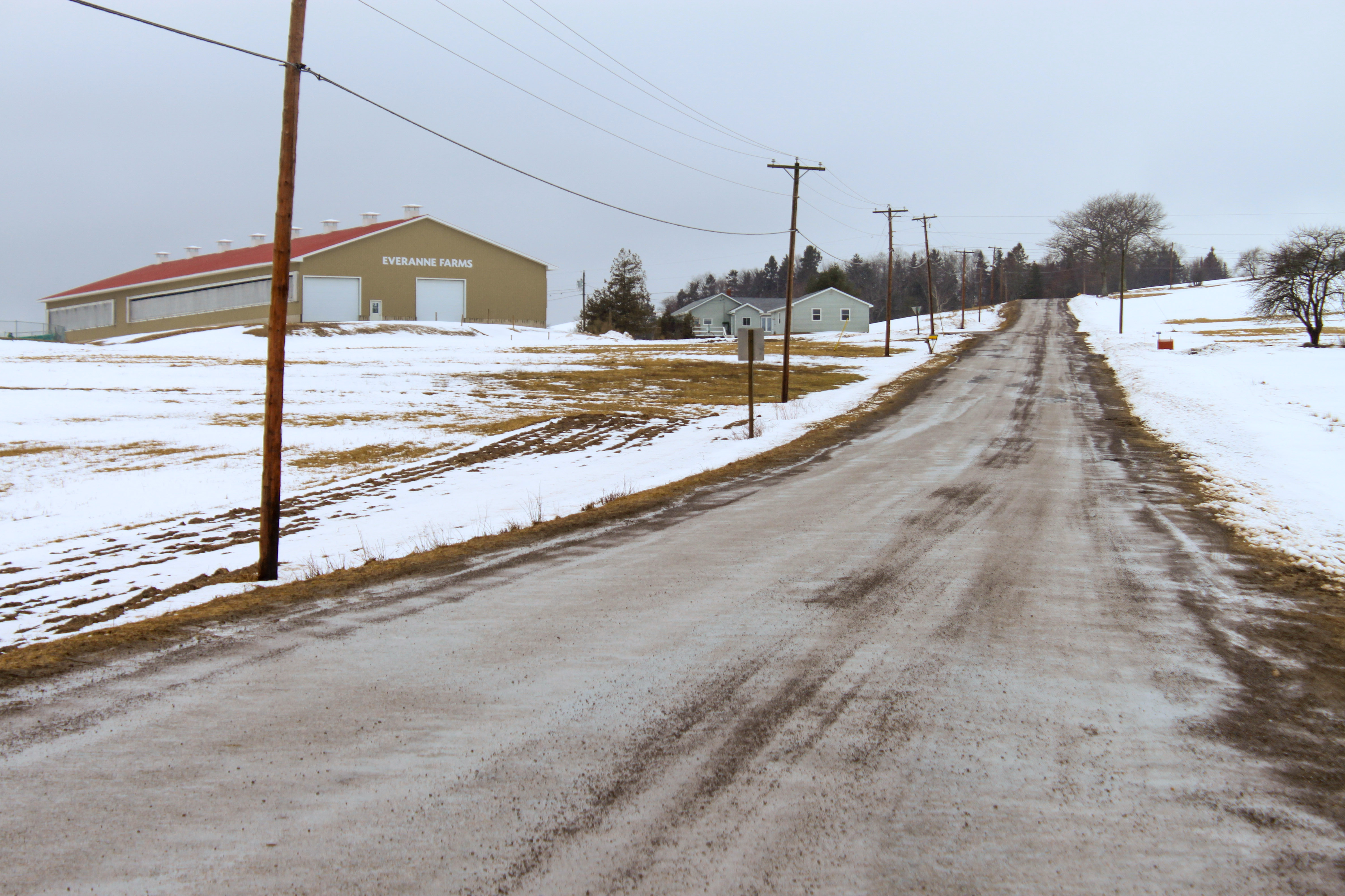
Traveling from Sussex on Route 1 take exit 175 at Norton. Turn right and travel 8.4 km on Route 124. Turn left onto the Upper Midland Road. After 2.8 km you will see a long fence line on your right. This is the start of the trail. You should be able to see the large barn for Everanne Farms on the hill in front of you (see picture to the right).
Trail Last Hiked: March 4, 2013.
Page Last Updated: Dec. 26, 2018.