Pine Point Trail
Gallery
Store

Quick Facts
| Difficulty | easy |
| Trail Type | loop |
| Distance | 2.5 km |
| Estimated Time | 1 hr return |
| Surface Type | old road, forested |
| Elevation Change | 18 meters |
| Features | lake, red pine |
| Trail Markers | white squares |
| Scenery Rating | beautiful |
| Maintenance Rating | well maintained |
| Cell Reception | none |
| Dog Friendly | on a leash |
| Fees | park entrance - cash only |
Description
The Pine Point Trail starts by following a dirt road that provides access to an old boat launch on Bathurst Lake. The road goes up over a small hill and opens into a small field at the boat launch. The small field has a nice view of the lake and a picnic table. The trailheads for the Big Brook Trail and Dry Brook Trail are at the right (west) of the field.
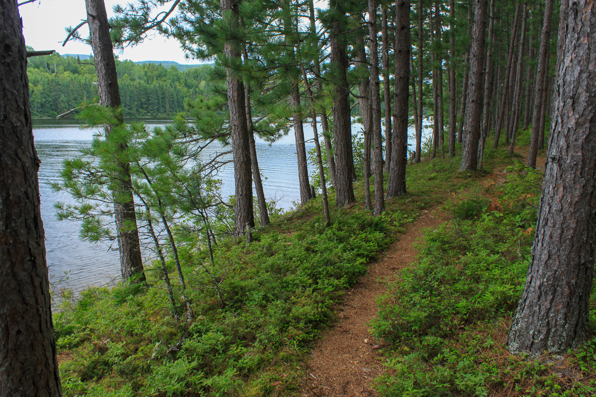
The Pine Point Trailhead starts on the left (south-east). The trail splits into a loop just after you start. The trail to the left climbs a small hill then goes through a section of Red Pine forest. The trail then drops down into a small ravine and follows a ridge of mixed forest before dropping down towards the lake. There are several small islands near this side of the point.

The trail then follows the lake shore around the point returning through the pure Red Pine stand. There are several views of the distant mountains across the lake from around the tip of the point. You can still see remnants of the stand's fire origins throughout the stand. Near the junction of the trail there is also an interesting Red Pine that has fallen over and is completely flat above the water of the lake but still holding on.
Map
Directions
For directions to the park go to the Mount Carleton Park page.
From the Park gate travel 1.3 km to the first road on your left. Turn left on this road towards the Armstrong Brook campground. You will immediately cross a small bridge over a brook. The road turns to the right after 9.4 km (old road goes straight). Continue another 3 km after the turn to the right. The trail head is on the right with a small loop road parking area. You will pass the entrance to the Armstrong Brook campground about half way. For directions to the park go to Mount Carleton Park.

From the Sign
Pine Point
It was only after the 1930's that men have been able to even try to stop forest fires. Major fires which swept over this area in 1923 and 1933 were partly responsible for the establishment of the fire warden system with towers such as the onee on top of Mount Carleton. Those hot, destructive fires burned both trees and the upper soil layers. Some types of trees never re-grew, for their seeds were gone and the scorched soil lacked nutrients they needed. The seeds inside the thick hard cones of the red pine survived to begin the unique pure forest covering "Pine Point".
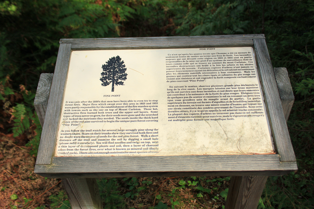
As you follow the trail watch for several large scraggly pine along the western shore. Scars on their trucks show they survived both fires and no doubt were the source of seed for the red pine forest. Walk a short distance off the trail and examine the soil by digging a small hole (please refill it carefully). You will find needles and twigs on top, next a thin layer of decomposed plants and soil, then a layer of charcoal ashes from the forest fires, over what is known as mineral soil (finely crushed rock). There are not enough nutrients for most species of trees but the vigerous red pine grew into a beautiful forest.

Trail Last Hiked: August 9, 2012.
Page Last Updated: April 1, 2020.