Mount Carleton Provincial Park
Map
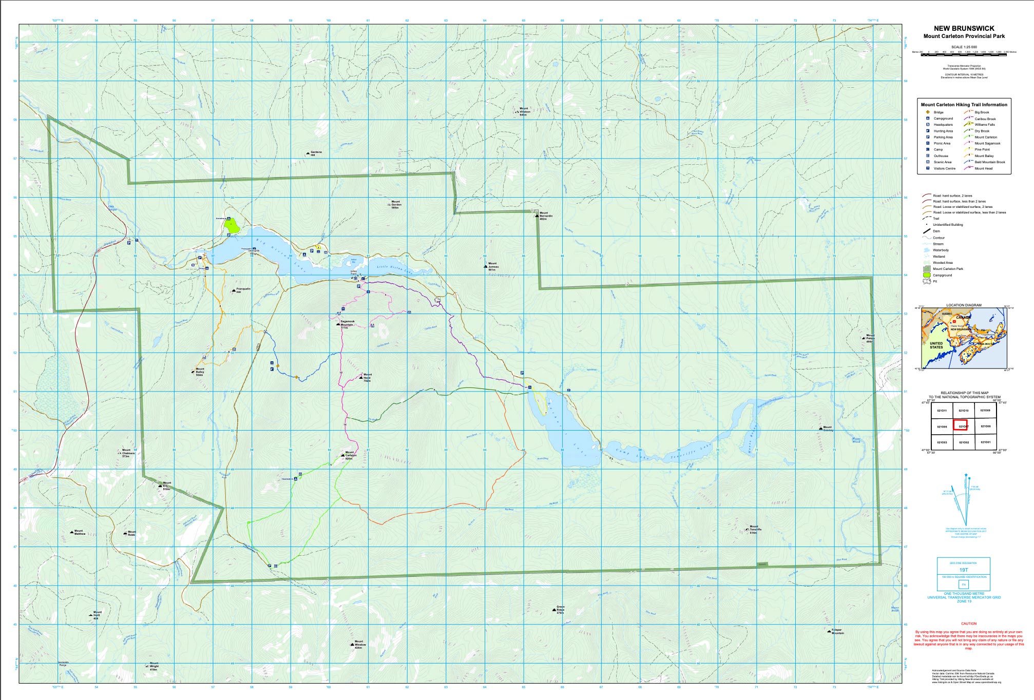
Description
Mount Carleton Park is a remote park in the most mountainous region of the province. The park is more than 17,000 ha of forest in the northern part of the province and is a 30 minute drive to St-Quentin, the nearest civilization. Mount Carleton is the highest peak in the Maritime provinces at 820 meters (2690 feet). The trails in the park are mostly to moutain peaks but there are also trails along lakesides, to waterfalls, and along an ancient portage trail. The ancient portage trails were used by First Nations thousands of years ago to travel between the lakes and river systems.
The park is open from mid-May to mid-October. The park is also open in winter and is plowed to Mount Bailey. Snowshoes, cross country skis and fatbikes are available to rent.
In the summer months the park has a day usage fee and only accepts cash due to its remoteness. The park has 11 trails ranging from a 15 minute walk on crushed rock to full day hikes on the mountains.
Galleries

Video

Directions
From Plaster Rock take Route 385 north for 76 km. You will find the entrance to the park on your right.
From St-Quentin take Route 180 east for 31 km then turn right onto Route 385. Travel for 9 km and you will see the park entrance on the left. Note that a section of route 385 is gravel.
From Bathurst take Route 180 west for 108 km then turn left onto Route 385. Travel for 9 km and you will see the park entrance on the left. Note that a section of route 385 is gravel.
Store

More Maps