Fundy Footpath
Gallery

Store
Quick Facts
| Difficulty | strenuous |
| Trail Type | linear |
| Distance | 8.3 km one way |
| Estimated Time | 5 hours |
| Surface Type | forested, beach |
| Elevation Change | 84 meters |
| Features | coastal views, beaches |
| Trail Markers | white blazes |
| Scenery Rating | must-see |
| Maintenance Rating | well maintained |
| Cell Reception | variable |
| Dog Friendly | on a leash |
| Fees | Park fees |
Description
Note: This trail description was created before construction on the Fundy Trail Parkway extension. The trail may be a bit different in places between Long Beach and the visitor center but will be well marked.
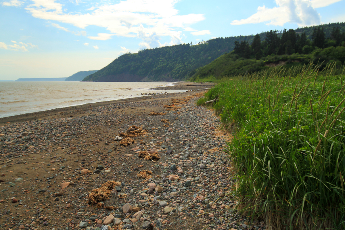
The Seely Beach to Big Salmon River section of the Fundy Footpath is the flattest section. The campground at Seely Beach is just off the beach in some trees on a point. On this point you can look back along the rugged fundy coast. In our opinion this is the best view on the whole trail.
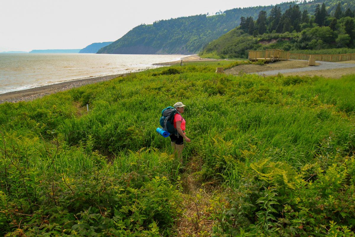
There is another campsite next to Seely Beach Brook. The brook crossing can usually be done without getting your feet wet by jumping on the large boulders. The best bet is to go upstream a bit to where it enters the woods. It may be more difficult to keep dry during spring runoff or after a rain storm. After crossing the brook you will return to the beach for a short walk before entering the woods.
After entering the woods it's a steady climb along the rocky shoreline. Erosion has made this section of the trail geologically interesting with many rocky outcrops and cliffs. A large, egg-shaped, four meter high rock called Dragon's Tooth balances precariously on the edge of a small cliff next to the trail. Although this section of trail is flatter it still has many smaller ups and downs making it strenuous.

There are several more large cliffs, and rocky outcrops that provide lookouts, before coming to Tufts Point. At Tufts Point there is an access trail down to the beach. From here there are several views of the bay as the trail flattens out. It travels through fields of ferns that used to be old farms. There is even a very old grave next to the trail.
The trail soon comes to the road at the Fundy Trail Parkway. It travels along the road for a bit and then dips down towards the picnic area at Long Beach. Long Beach is aptly named for it's long beach reaching off to the east. The beach can be seen from some of the first lookouts on the Fundy Trail Parkway.
The trail crosses another rocky, shallow stream before entering the woods once again. The trail then steadily climbs to more fern fields and lookouts. The ground is more gravelly here and erosion has formed several small valleys that slope off towards the bay. The trail then travels through the woods between the beach and the road.
The trail reaches several lookouts before coming to the Big Salmon River campsites. These campsites are now closed. The campsites are sheltered in the woods away from the coast. The trail then travels towards the point at the mouth of Big Salmon River where there is another lookout and a small, steep trail that provides beach access.
The trail travels along the contour of the hill along the river before reaching several cable staircases that take you down closer to the beach. You will soon come to a trail that climbs the hill to the right. This trail will take you up to one of the Big Salmon River lookout along the Fundy Trail Parkway.
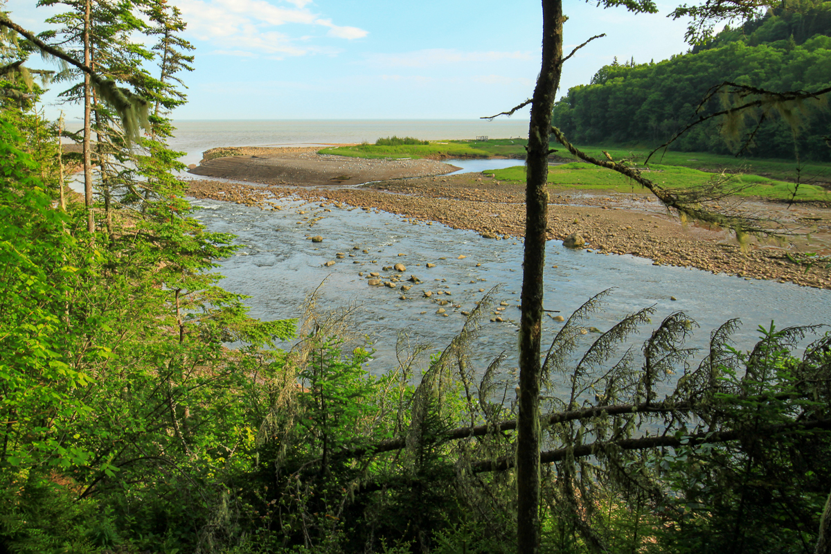
Soon the trail drops down to the gravel beach along the river. After a short distance across the floodplain you will find a crushed rock trail that climbs a hill underneath a cement bridge. Beyond the cement bridge is the walking bridge that will take you across the river. After crossing the walking bridge the trail turns left and heads towards the parking lot below the visitor center.
Note: all distances are horizontal GPS distances. They do not take into account the many steep ups and downs which add distance.
Map

Elevation Profile

Directions
The best way to access this section of trail is the Fundy Trail Parkway Visitor Center or from the Little Salmon River to Seely Beach section of the Fundy Footpath.
You can also access the Footpath from the Big Salmon River Lookout, the picnic area at Long Beach, or from the Seely Beach Access Trail.
Other sections of the trail:
Trail Last Hiked: July 5, 2015.
Page Last Updated: July 27, 2019.