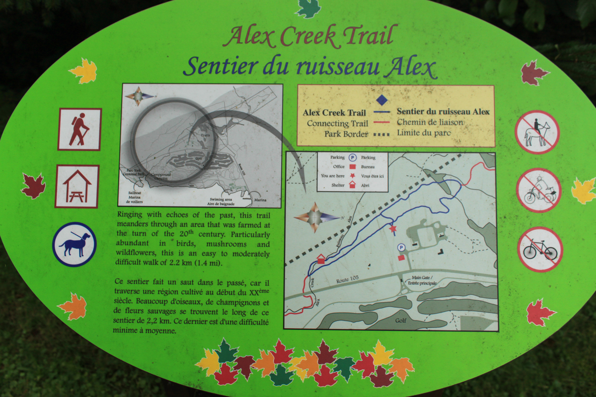
Alex Creek Trail
Mactaquac Provincial ParkVideo
Store

Quick Facts
| Difficulty | easy |
| Trail Type | loop |
| Distance | 2.1 km |
| Estimated Time | 45 minutes |
| Surface Type | wood chips, forested |
| Elevation Change | 26 metres |
| Features | beaver pond, stream |
| Trail Markers | blue square with white stripe |
| Scenery Rating | special features |
| Maintenance Rating | well maintained |
| Cell Reception | strong |
| Dog Friendly | on a leash |
| Fees | none |
Description
The Alex Creek Trail is at the centre of Mactaquac Park and is the most diverse trail in the park. The beaver dams along the Beaver Pond to Alex Creek Connecting Trail flow into a long narrow beaver pond at the start of the trail. From there the trail forms a long narrow loop through a mainly spruce forest. The access trail from the park office bisects this long narrow loop.
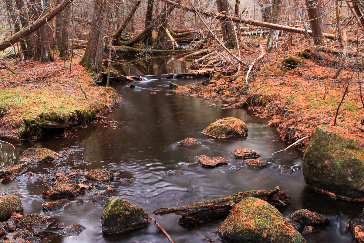
Continuing to the southeast (left if entering from the office), the long narrow loop eventually drops back down into the Alex Creek valley. Tucked in the valley you will find one of two shelters in the park (the other is on the Little Mactaquac Trail). Shortly after the shelter, the trail turns to the right and crosses Alex Creek on a small covered bridge. The trail then follows the stream until it reaches the junction with the Alex Creek to Murch Field Connecting Trail. Near the junction there is another smaller bridge over the stream. Cross this bridge and the trail will take you back up the stream in the direction you came.

One hundred years ago this whole area would have been farmland. Look for rock walls and branch spruce as indicators of this lands past.
Map

Gallery

From the Sign
The balsam fir
The Balsam Fir, the Provincial tree of New Brunswick, is world renowned as a Christmas tree. It is native to most of Eastern and Central Canada and the Northeastern United States.
It is a small to medium-size evergreen tree typically 14-20 m tall, with a narrow conical crown.

The Balsam fir is best identified by it's flat, soft, fragrant needles with unique cones which stand upright. It has a gray bark with raised resin blisters.
The cones are erect, 4-8 cm long, dark purple, ripening brown to release their winged seeds in September.
The Balsam Fir is a favourite food of the ruffed grouse.
From the Sign
The red spruce
Red spruce, the Provincial tree of Nova Scotia is a coniferous tree native to eastern North America. Specifically, its habitat ranges from eastern Quebec to Nova Scotia.
Red spruce is an important wood used in making paper pulp. It is also an excellent tonewood used in many higher-end acoustic guitars. The red spruce is the preferred tree for collecting and making spruce gum. Also, leafy red spruce twigs are boiled in the making of spruce beer.

It grows from 18-30 m high and has a trunk diameter of about 60 cm.
The leaves are needle-like, yellow-green, 12-15 mm long, four-sided, curved, with a sharp point, and extend from all sides of the twig.
The cones are cylindrical, 3-5 cm long, with a glossy red-brown color and stiff scales. The cones hang down from branches.
Directions
For directions to the park go to the Mactaquac Provincial Park page.
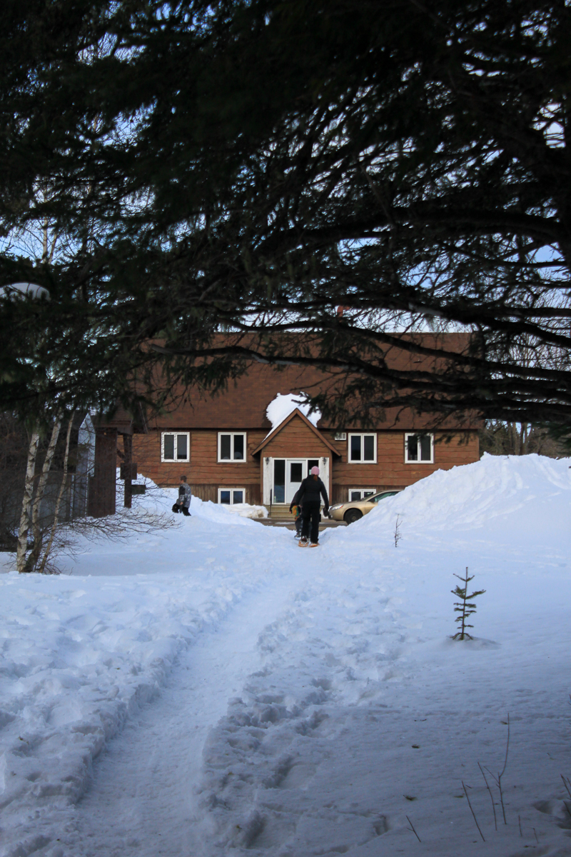
If you are coming from the direction of Mactaquac dam, cross the causeway near the marina and climb the hill. At the top of the hill you will start passing the golf course on the left. You will soon come to the driveway to the office on the right (just before coming to the main gate on the golf course on the left). Turn into the office and park along the back of the parking lot behind the office.
If you are coming from the Nackawic direction on route 105, you will come to a clearing with small fields on both sides of the road. Just after coming to these clearings you will see the main park gate on the right and just past this the driveway for the park office on the left. Turn into the park office and park along the back of the parking lot behind the office.
The main trail entrance leaves the parking lot behind the office near a shelter. It crosses a small field and then enters the woods. You can also access this trail from the Beaver Pond to Alex Creek Connecting Trail and the Alex Creek to Murch Field Connecting

From the Sign
Alex Creek Trail
Ringing with echoes of the past, this trail meanders through an area that was farmed at the turn of the 20th century. Particularly abundant in birds, mushrooms and wildflowers, this is an easy to moderately difficult walk of 2.2 km (1.4 mi).
Trail Last Hiked: April 13, 2024.
Page Last Updated: April 18, 2024.