Fallsview Park Trails
Gallery
Store

Quick Facts
| Difficulty | easy |
| Trail Type | mixed |
| Distance | 1.1 km |
| Estimated Time | 45 mins |
| Surface Type | pavement, grass |
| Elevation Change | 21 metres |
| Features | Reversing Falls |
| Trail Markers | none but easy to follow |
| Scenery Rating | beautiful |
| Maintenance Rating | well maintained |
| Cell Reception | strong |
| Dog Friendly | on a leash |
| Fees | none |
Description
Fallsview Park starts at the looped parking lot that overlooks the river and the Reversing Falls. The Reversing Falls is a narrow part of the river that is impacted by the extreme tides in the Bay of Fundy. Twice a day the tide comes in high enough to push water up river into the St. John River basin. This means that the swirling waters change direction twice a day. A very fascinating thing to see with this much water.
There is a pulpmill directly across the river and a few small islands just off shore. The islands attract many seagulls and cormorants for nesting. On my last visit I watched several seals swim up through the river, taking advantage of the tides.
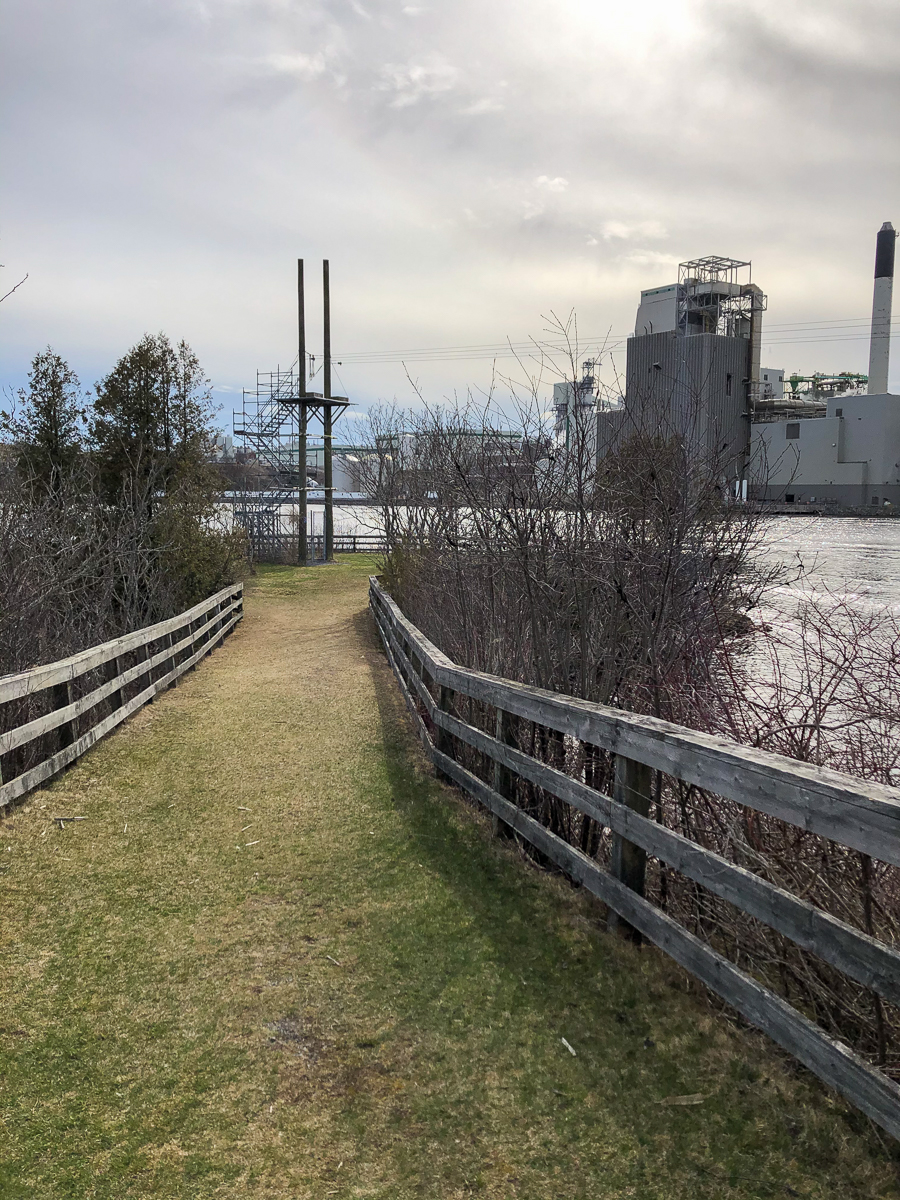
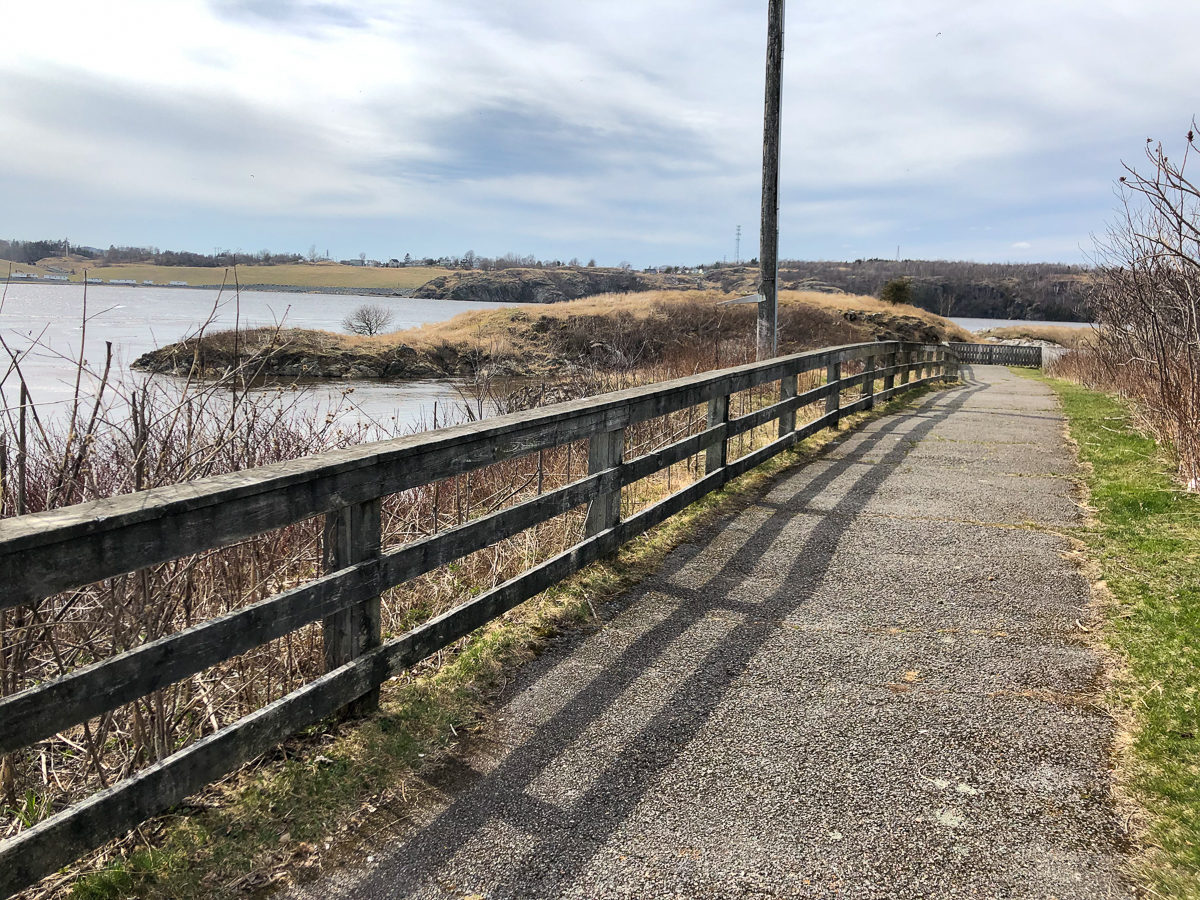
If you turn right from the parking lot you will find a long, paved trail that goes out to a lookout over the islands. You can continue past the end of this lookout and follow a narrow trail along the clifftops. The trail goes out to a point. At the point the trail drops down to a small field at water level where you can access the shore. There are cement structures along the trail that indicate the point may have been used for some type of industrial operations in the past. From the point you can continue to follow an old road along the shore that loops back up to the entrance to the parking lot.
If you go turn left at the parking lot you will first come to a wide lookout platform down below the parking lot. The lookout has several interpretive signs explaining the construction of the bridge and of the geology of the Reversing Falls. Continue past the lookout and a wide crushed rock trail will take you up the hill towards a large shelter. From here the grassy trail takes you to several zipline towers, ending (both zipline and trail) at a point out in the river. If you are adventurous you should definitely try the zipline while you are there.
Map


Directions
If you are coming into Saint John from the Fredericton direction, take exit 119 on the way into Saint John. Turn left on Bleury Street and then right at the lights on Fairville Boulevard. Drive up the hill and at the intersection near the pulp mill continue straight across the Reversing Falls Bridge. Just after crossing the bridge turn left onto Douglas Avenue. Drive for a short distance and turn left onto Fallsview Avenue. This will take you to the parking lot overlooking the river.

If you are coming into Saint John from the Sussex direction, take exit 123 and at the lights continue straight on Paradise Row. After a short distance the road splits so keep right on Route 100 west. After 1 kilometre turn left onto Douglas Avenue. Drive for another 1.4 kilometres and look for Fallsview Avenue on the right. Fallsview Avenue will take you to the parking lot overlooking the river.
From the Sign
Reversing Falls Rapids
Welcome to Stonehammer UNESCO Global Geopark. We tell a billion years of stories about planet Earth, connecting stories of geology with stories of community.
About 20,000 years ago the last continental glaciation reached its maximum. Glaciers covered all of the Maritimes. As the glaciers retreated they left a changed landscape. Before the last glaciation the Saint John River flowed to the sea through South Bay, past the Irving Nature Park. Retreating glaciers left piles of sand and gravel called moraines that dammed that river outlet. When the river found its new route about 14,000 years ago it flowed over the rock ridges at Reversing Falls Rapids to create this gorge.

Thousands of years ago a waterfall existed here, but as sea level rose and the riverbed eroded, the waterfall was drowned. The phenomenon of the Reversing Falls Rapids is only about 3,000 years old. A profile of the riverbed shows a series of waterfalls must have existed here starting near the islands at Fallsview Park and ending near the bridges. Just past the islands the river bottom drops to about 25 metres below low water level. It then drops two more times to more than 40 metres below low water level just past the road bridge.
From the Sign
Bridging the Gorge
There have been four endeavors to build a bridge spanning the Reversing Falls gorge and rapids, including the St. John Bridge Company's ill-fated attempt in 1837. On August 8 of that year, the partially-completed bridge collapsed, sending seven workmen to their death. Nine years later, an American entrepreneur convinced local businessmen that bolting one plank to another and extending them over the gorge would work. His theory wilted when the structure collapsed after projecting out little more than 10 m. In 1849, William K. Reynolds issued a prospectus for the St. John Suspension Bridge Company and three years later, the first successful bridge was opened to the public. Reynolds and his firm chose their engineer well: Edward W. Serrell was also the designer of the first bridge to span Niagara Falls. Given the first failed attempts, the nervousness of the public over crossing the span could be well appreciated. Although consultant engineers declared that the bridge was indeed safe, an eventful 1858 storm destroyed a portion of the structure's deck, leaving the regularly-scheduled Fredericton stage coach only feet from plunging into the depths of the gorge. Having a bridge was a more significant development than just providing ease of local transportation; it actually became Saint John's principle link for north-south trade with the United States. Two of the suspension bridge's stone piers continue to be useful as part of the foundation of the Reversing Falls Visitor Information Centre. In 1915, the current bridge was erected, an access-way greatly aiding in the mobility and prosperity of the city. Up river of the current road bridge can be seen where an original cantilever railway link was built in 1885. It was replaced by the current railway structure in 1921. The granite piers which support this viewing deck once supported a bridge across the river.

From the Sign
A Reversing, Rushing Torrent
The superlatives 'natural wonder' and 'phenomenon' are sometimes used in exaggeration. Not so in the case of Saint John's rushing torrent of water known as the Reversing Falls. Rivers everywhere feed the world's oceans. What's unusual is that twice each day the Saint John Harbour pushes back, overcoming the river current and making the water fall five metres in the opposite direction. The abnormality can be blamed squarely on the Bay of fundy, a dynamic marine eco-system known for producing the world's most extreme tides. During the time between these contrary events, the water's surface rests placidly at half tide, allowing vessels to come and go through the 15-metre wide gorge in relative safety. While the Reversing Falls are exciting to watch, the havoc created by Fundy's tidal flow through the gorge has brought peril to many, including those who have paid the ultimate price. The worst recorded disaster in the history of the Reversing Falls occurred on August 2, 1838 when nineteen of twenty-five people perished after their vessel had a brush with the rocks and capsized. The victims, mostly women and children on their way to a berry-picking excursion up-river, were unable to survive the eddies, whirlpools and rapids. The New Brunswick Courier referred to the event as a 'melancholy catastrophe.' This and other incidents remind all that the Reversing Falls is an unpredictable natural wonder and a phenomenon worthy of respect and caution.

Other Trails in nearby
Trail Last Hiked: April 16, 2021.
Page Last Updated: November 28, 2021.