Belleisle Creek Marsh Trail
Gallery
Store

Quick Facts
| Difficulty | easy |
| Trail Type | linear |
| Distance | 2.2 km one way |
| Estimated Time | 1 hr 30 mins |
| Surface Type | old road |
| Elevation Change | 27 metres |
| Features | marsh, creek |
| Trail Markers | signs |
| Scenery Rating | beautiful |
| Maintenance Rating | well maintained |
| Cell Reception | medium |
| Dog Friendly | on a leash |
| Fees | none |
Description
The Belleisle Creek Marsh Trail was a wonderful find when I accidentally drove by it looking for Henderson Falls. The trail starts by crossing two fields separated by a strip of forest. On my visit I spooked a small doe deer in the second field. As the trail comes out of the woods into the second field you will see what looks like an old abandoned garden on the right, including a shelter.
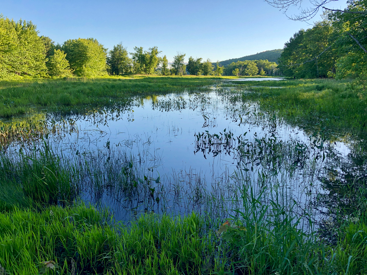
After passing through the second field you will enter a patch of beautiful hardwood and soon come out to the marsh. There is water crossing the trail here but its easy to cross with the evenly spaced rocks that someone has placed here for that purpose. The trail then takes a sharp right and follows and old road, passing through beautiful hardwood stand. The marsh is close by on the right.
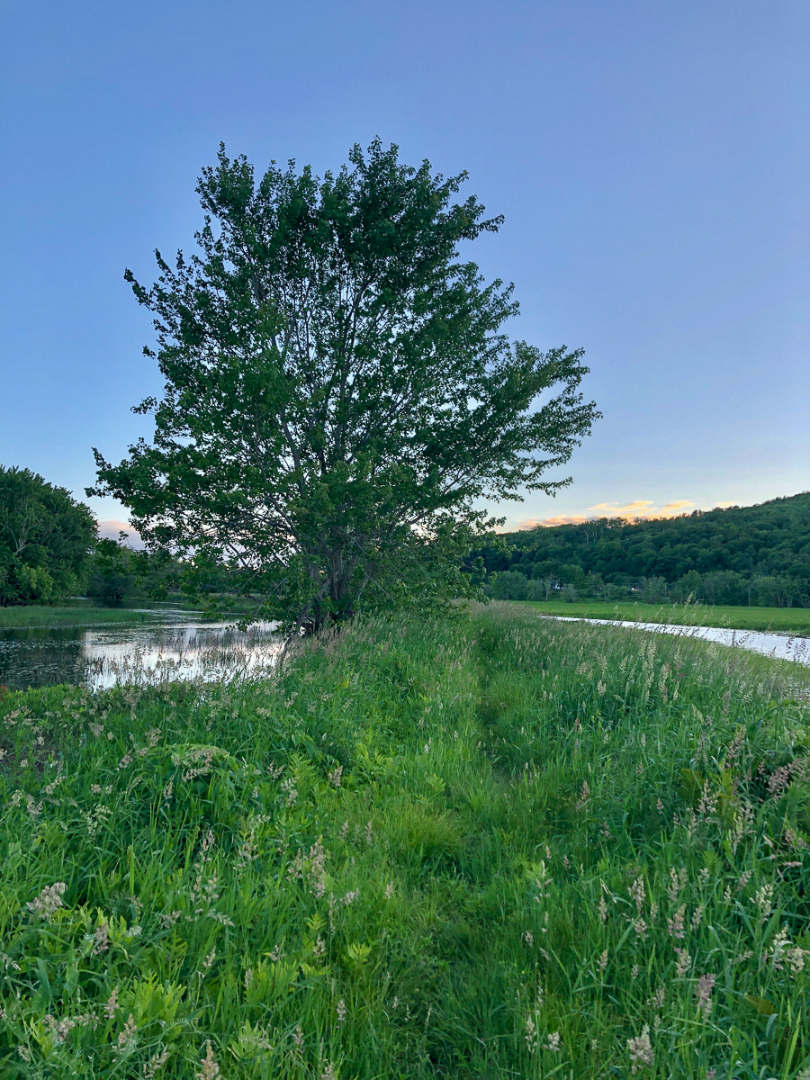
The trail soon comes close to Ketchum Brook on the left. The rest of the trail travels along a narrow berm between the marsh and the Brook. In this section the grass is tall making it hard to see the trail underneath. Use caution to keep from twisting an ankle. Also use caution because I saw a small bird in the trail scurry deeper into the grass near where I stepped. I stepped in several small ditches hidden under the grass that were created by water flowing over the trail. In one of them I came very close to stepping on something that shot out of the hole. I think it was a beaver!
From the trail you will start to see views on the left of Belleisle Bay. The trail eventually comes back out to a wide parking area and boat launch further down route 124. Before you get to the parking area you may come to a wider spillway that crosses the trail. It was too wide for me to cross without wading through ankle deep water so I returned the way I came.
This trail was very dense with wildlife. I saw deer, beavers, many different types of ducks, an eagle, and an aggressive Red-winged Blackbird, who I think was nesting in one of the trees next to the trail. I would recommend long pants for protection from ticks.
Map

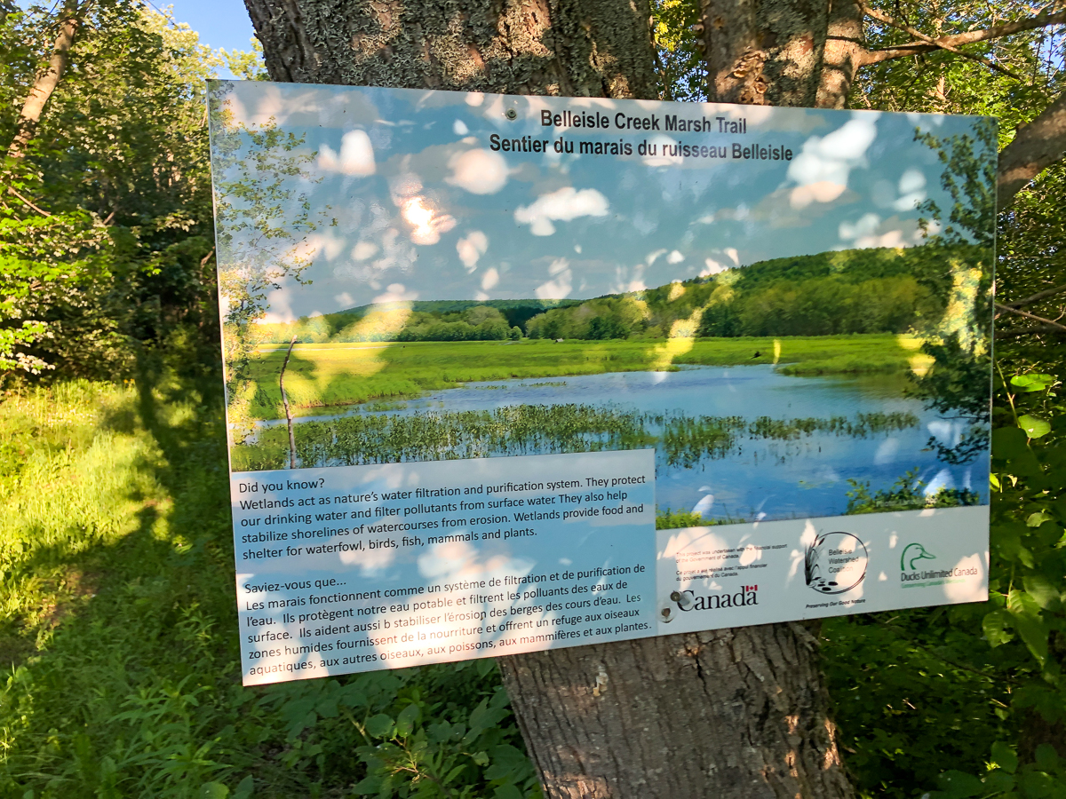
From the Sign
Belleisle Creek Marsh Trail
Did you know?
Wetlands act as nature's water filtration and purification system. They protect our drinking water and filter pollutants from surface water. They also help stabilize shorelines of watercourses from erosion. Wetlands provide food and shelter for waterfowl, birds, fish, mammals and plants.
Directions
From Cambridge-Narrows head south on route 695. After 20 kilometres you will come to a stop sign in Springfield. Turn right at the stop sign towards Evandale. After 1.5 kilometres you will see a parking lot for the trail on the left, across from the vineyards of Gillis of Belleisle Winery.

From Norton head west on route 124. Continue on route 124 for 13 kilometres and you will see a parking lot for the trail on the left, across from the vineyards of Gillis of Belleisle Winery.

Other trails nearby
Trail Last Hiked: June 22, 2022.
Page Last Updated: November 21, 2022.