Black Beach Trail
Gallery

Quick Facts
| Difficulty | moderate |
| Trail Type | loop |
| Distance | 4.4 km |
| Estimated Time | 1 hr 30 mins |
| Surface Type | forested |
| Elevation Change | 40 meters |
| Features | estuary |
| Trail Markers | red markers over blue paint |
| Scenery Rating | beautiful |
| Maintenance Rating | well maintained |
| Cell Reception | strong |
| Dog Friendly | yes |
| Fees | by donation |
Podcast
Episode 19: A Tour of the Musquash Head Lighthouse
Description
Black Beach is a unique beach made of black sand. The sand is caused by the graphite deposits around the beach. From the main parking lot the trail climbs an old road to an old parking lot that overlooks the estuary. From here you will see the trail head sign. There is a small set of stairs to the left of the sign that takes you down to the Black Beach Trail. This is the western side of the loop that takes you closest to the coast. The other side of the loop can be found on the right just before the old parking lot.
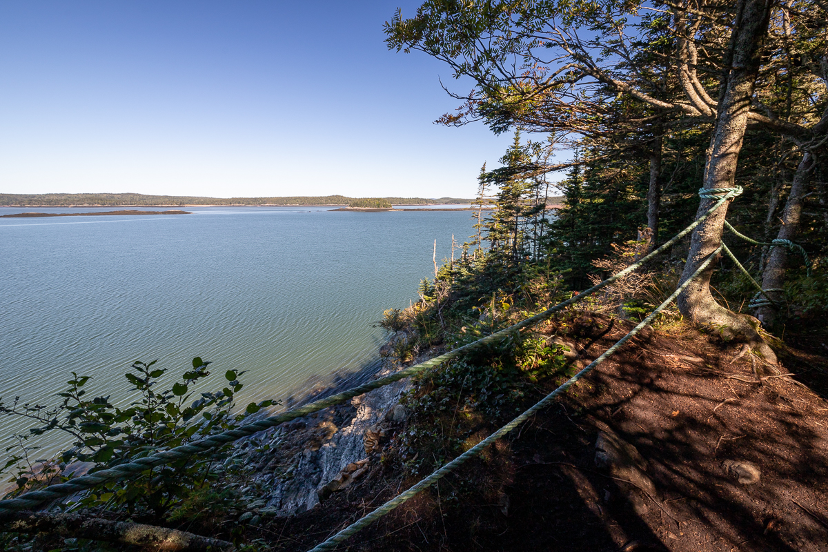
The trail travels through a mossy, spruce, coastal forest with a few lookouts overlooking the estuary. There are rocky outcrops and knarly trees along the trail. At the end of the long loop trail there is a lookout overlooking Frenchmans Creek. The trail returns through the forest farther away from the coast. There is a cross trail about mid way that allows you to make a shorter loop.
Map
Store

From the Sign
The Musquash Estuary
Habitats and animals of the Musquash Estuary Nature Preserve
The Musquash Estuary has a great deal of biodiversity because of the many different types of habitat found in this remarkable place. The beaches of the outer estuary give way to meandering salt marshes as you move up river, and diverse coastal forests and bogs surround the waters. There are also a variety of marine habitats and species hidden under the waters of the estuary.
Around the outer estuary a variety of shore types occur, some are sandy like Black Beach, where unique black sand comes from graphite deposits. Rocky shores support tidal pools and canopies of seaweeds that shelter invertebrates.

The forests surrounding the estuary are influenced by the cool maritime climate. The most common forest type of the coast is Red Spruce mixed with Yellow Birch and Red Maple. The forest floor is carpeted with ferns and flowering plants such as Bunchberry, Wood Sorrel and White Aster.
Harbour Seals can frequently be seen sunning themselves in large groups on rock ledges in the estuary at low tide.
Over 290 species of birds have been reported in the Musquash Estuary. Flocks of Common Eider and Surf Scoters are often seen feeding on the open water, while Peregrine Falcons nest on the cliffs near Black Beach.
Moose are common in the forests, bogs and fens around the estuary.

Directions
The Black Beach Trail is accessed from Black Beach. To get to Black Beach take exit 112 from the highway and turn towards Lorneville. Drive for 8 kilometres and you will come to the Coleson Cove power station. When you get close to the power plant the road splits. Keep to the right on Black Beach Road.

After the road splits it soon turns to gravel. Just past the power plant you will pass the trailhead for the Split Rock Trail on the left. Continue on this road for another 2.6 kilometres past the split and you will arrive at Black Beach. Park here. An old road climbs the hill to the right overlooking the beach. The trailhead sign is at the top of this hill
You can access the other end of the Black Beach Trail through the Lorneville Link Trail that links to the Five Fathom Hole Trail.
Other Trails in the area
Trail Last Hiked: September 5, 2020.
Page Last Updated: May 29, 2021.