Sea Dog Cove Nature Preserve Trails
Gallery

Quick Facts
| Difficulty | easy |
| Trail Type | linear |
| Distance | 1.4 km |
| Estimated Time | 1 hr |
| Surface Type | old road, forested |
| Elevation Change | 45 meters |
| Features | river, cove |
| Trail Markers | none but easy to follow |
| Scenery Rating | beautiful |
| Maintenance Rating | well maintained |
| Cell Reception | medium |
| Dog Friendly | yes |
| Fees | donations accepted |
Podcast
Episode 2: Finding the Views at Sea Dog Cove
Description
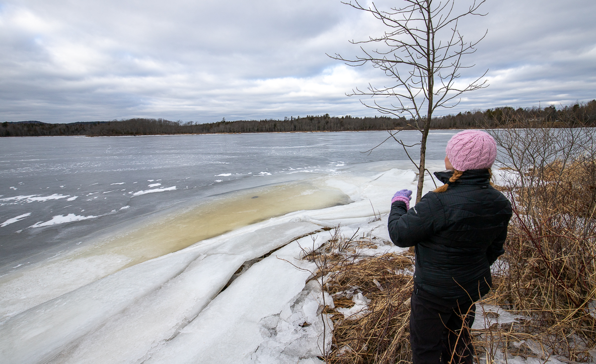
The trail is grassy and mowed. It is wide and easy to follow. The trail down to Sea Dog Cove descends past a wide area and a large hardwood tree. The trail goes through an old field with tall grass and bushes. At the end of the trail you have to go through a few feet of deep grass and bushes to get to the shore. The shore is rocky and marshy with lots of seaweed. There are views of Sea Dog Cove in every direction. Kennebecasis Island is what you see across the cove to the left.
The trail to the lookout starts by following an old road. The trail turns sharply to the left and crosses a muddy area that is covered by a small bridge. Just past the bridge the trail turns sharply to the right. To your left you will see someone's back yard. The trail then goes through alternating mixed forest and spruce thickets. After a while the trail veers to the left and travels along the cliff tops. The trail comes out to an opening at Barlow's Bluffs with small views out through the trees. Continue straight across the opening. To the left you will find a trail that descends to a rocky outcrop. The rocky outcrop provides the best view of the Kennebecasis River. To the right you will see the ferry dock.
The Sea Dog Nature Preserve is owned and managed by New Brunswick Nature Trust. Consider supporting them.
Map
Store

From the Sign
Sea Dog Cove Nature Preserve
In 2006, this property was given to the Nature Trust as an EcoGift by owners David and Rosie Jory who wanted to protect their property from subdivision and development, while making the land accessible to the public. The present day Sea Dog Cove Nature Preserve is a 30.26 hectare (75 acre) property with 700 metres of shoreline. The 400 metre marshy shore along Sea Dog Cove is vegetated with such plants as blue flag iris (Iris versicolor), broadleaf cattail (Typha latifolia), and pondweed (Potamogeton sp.). It is surrounded by a riverine forest of mountain ash (Sorbus americana), Eastern white cedar (Thuja occidentalis), and red maple (Acer rebrum). The cove is also a foraging area for a number of waterfowl, including the double-crested cormorant (Phalacrocorax auritus), common loon (Gavia immer), green-winged teal (Anas crecca), and American widgeon (Anas americana).

The remaining shoreline on the Kennebecasis River at the rocky Barlow's Bluff is a steep slope covered in mature red spruce (Picea rubens), balsam fir (Abies balsamea) and Eastern white cedar (Thuja occidentalis) that leads to the rocky shore and a small cobbled beach. This section of the preserve also contains a cliff face that is of the same geological composition as the nearby Minister's Face Nature Preserve on Long Island.

Directions
From the Ferry between Grand Bay-Westfield and Hardings Point on the Kingston Peninsula, continue on Hardings Point Landing Road. After 1.5 km turn right onto route 845. After 12 km you will come to a stop sign at a junction. Turn right onto Summerville Road. After 900 meters you will see the sign for the Sea Dog Cove Nature Preserve on your left.
The trail to the lookout starts just beside the sign. A trail directly across the road leads down to the shore at Sea Dog Cove. Park along the road beside the trails.

From the Sign
DID YOU KNOW?
- The preserve is named 'Sea Dog Cove' for the harbour seals (Phoca vitulina), who give birth on islands in the cove and can often be seen in the area, particularly in late winter.
- During the 1980s, David and Rosie Jory planted four thousand red pines through the forest, the majority of which are on the eastern section of the preserve.
- The eastern section of the preserve contains hundreds of pink lady's slippers (Cypripedium acaule), which are best viewed between May and June.
From the Sign
IMPORTANT VISITOR INFORMATION
Visitors are asked to explore and enjoy the natural area with respect, as well as exercise extreme caution when visiting the steep, rocky portion of the preserve at Barlow's Bluff. When the pink lady's slipper and other native wildflowers are in bloom during the spring and summer season, please ensure to enjoy them without picking the flowers. Picking the flower lessens their ability to reproduce the following year.
External Links
Trail Last Hiked: December 29, 2019.
Page Last Updated: January 12, 2020.