Williams Trail
Gallery

Store

Quick Facts
| Difficulty | moderate-difficult |
| Trail Type | linear |
| Distance | 3 km one way |
| Estimated Time | 2.5-3 hrs return |
| Surface Type | forest, rock |
| Elevation Change | 63 meters |
| Features | coastal views, gravel beaches |
| Trail Markers | none but easy to follow |
| Scenery Rating | beautiful |
| Maintenance Rating | well maintained |
| Cell Reception | medium |
| Dog Friendly | yes |
| Fees | none |
Description
Williams Trail is a rugged trail that travels along the coastline south of Saint John. The trail starts at Cape Spencer Lighthouse at the end of Red Head Road. There is a small parking area on the right at the end of the road. If its busy cars park along the road, but be careful that you don't block anyone in. Walk off the end of the road and past a cement pad and keep to the right. The trail will descend through a field with epic views of the coastline, before entering the woods on the right. Note that there are also several other small trails in front of the lighthouse that provide access to the rocky shoreline.

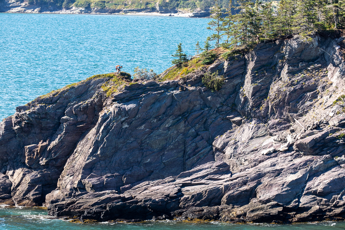
The trail travels along the clifftops with many views of the coves, beaches and spectacular Bay of Fundy. On my visit the water was a bright turquoise in color. The trail is sometimes quite exposed near cliff edges so use caution. There are signs warning exposed sections of trail. There are also many ups and downs. Some of the steeper ones have ropes to help. None of the hills are very big. When I was there the trail was fairly new and had a lot of black mud, which was slippery. This may not be the case after this trail gets more use.
There are kilometre markers along the trail to show you your progress. There are many side trails that go out to lookouts. Some of them are narrow rocky ridges so use caution. After about half way, as the trail turns back towards Saint John, you will start to see the Irving Oil Refinery in the distance, and the many oil tankers that come and go.
The trail passes by Ploughshare Rock, a large rocky outcrop just off shore. After crossing Millican Brook you will find a side access trail to Shark Rock Beach. Shark Rock is a large rocky outcrop just offshore (accessible at low tide) that looks like a giant shark's fin. There are several other rocky sea stacks beyond this point. When you come to the 3 kilometre sign you will see the end of trail sign just beyond it. A side trail takes you out to one last lookout before you make your way back the way you came.
Read this CBC article to find out how the trail came to be and how it got its name.
Map

Directions
From the highway in Saint John take exit 125 and head south on Seely Street. Continue straight through a set of lights and the road turns into Bayside Drive. After 2.6 kilometres you can either turn right onto Red Head Road, or continue straight on Bayside Drive. The two roads come together again after 9 kilometres. When the two roads come together turn left (or continue straight) onto Red Head Road. Drive for another 8.8 kilometres and you will come to the end of the road at Cape Spencer Lighthouse.
Park in the little parking area on the right at the end of the road, or park along the road. The trail continues off the end of the road. Keep right after passing a cement pad.

Other Trails in Saint John
Trail Last Hiked: September 5, 2020.
Page Last Updated: April 18, 2021.