Westcock Dyke Trail
Gallery
Store
Quick Facts
| Difficulty | easy |
| Trail Type | linear |
| Distance | 2.1 km one way |
| Estimated Time | 1 hr 30 mins |
| Surface Type | road, grass |
| Elevation Change | 4 meters |
| Features | mudflats |
| Trail Markers | none but easy to follow |
| Scenery Rating | beautiful |
| Maintenance Rating | variable |
| Cell Reception | strong |
| Dog Friendly | yes |
| Fees | none |
Description
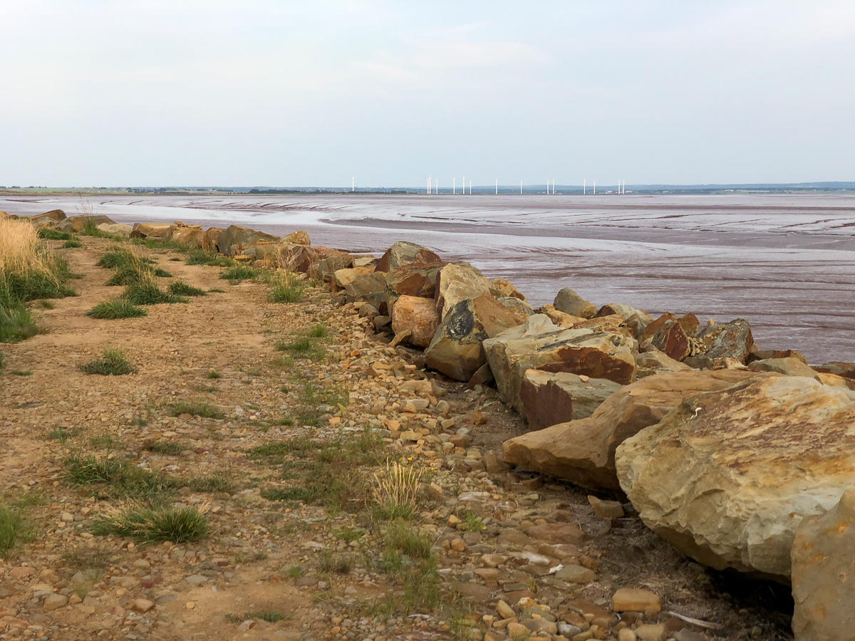
The Westcock Dyke is a long, tall berm that separates the salty waters of the Bay of Fundy from the farm fields at Westcock Marsh. The dyke is wide enough to have a rough road along the top of it. This road makes up the trail. To the left the road is quite pronounced and clear of grass. To the right the road is grown in with thick grass. At low tide the dyke overlooks the extensive mudflats where the Tantramar River flows into the Bay of Fundy. In the distance you will see the large windmills on Tantramar Marsh, just over the border in Nova Scotia.

You will notice deep ditches criss-crossing through the fields. There are only a few places where a culvert allows water to flow out through the dyke. These culverts (called aboiteau) are made with a one-way valve that allows water to flow out but doesn't allow salt water to flow back in. It wouldn't be possible to farm these fields if saltwater was allowed to flow in.
If you want to extend your walk beyond the 2 kilometres of cleared dyke you can walk around the fields on the roads.
On my visit in October there were thousands of Semipalmated Sandpipers eating mud shrimp in the mudflats. They flew and walked up and down the shore in the deep mud. Palmated means webbed feet. These partially webbed feet help them wade in the soft mud. They were fascinating to watch.
Map

Directions
Drive through downtown Sackville and continue on route 106 towards Dorchester. After a couple of kilometres route 106 turns sharply to the right. Before this turn continue straight on Wood Point Road. Continue on Wood Point Road for just over 2 kilometres and you will come to a junction with Barren Ground Hill Road and Old Hospital Loop Road. Turn left onto Old Hospital Loop Road.
After a short distance the Hospital Loop Road will turn sharply to the left. Before this turn continue straight onto Westcock Marsh Road. From here the road is gravel but it's usually in good shape. Continue on this road across the fields. Just before you get to the dyke you will pass a road on the left. Continue past this road and there is a sharp turn to the right. Just past this turn the road climbs up onto the dyke. Park where you feel comfortable but make sure you aren't blocking any roads. On my visit I parked up on the dyke.

Trail Last Hiked: August 22, 2021.
Page Last Updated: December 11, 2021.