Old Scoudouc Train Bridge Trail
Gallery
Store

Quick Facts
| Difficulty | easy |
| Trail Type | linear |
| Distance | 600 meters |
| Estimated Time | 15 minutes return |
| Surface Type | gravel |
| Elevation Change | 8 meters |
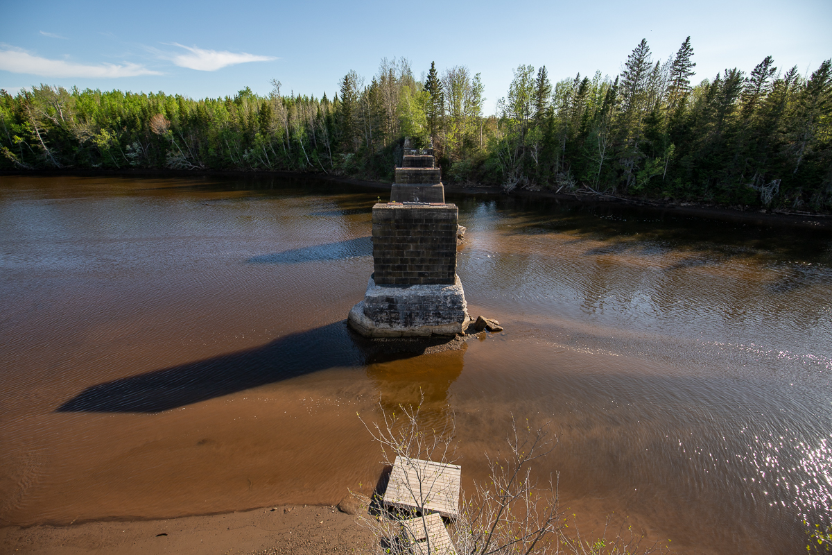
| Features | river, bridge abutments |
| Trail Markers | none but easy to follow |
| Scenery Rating | beautiful |
| Maintenance Rating | well maintained |
| Cell Reception | strong |
| Dog Friendly | yes |
| Fees | none |
Description
The wide, gravel trail travels along an old railbed for 600 meters. It travels along several back yards before coming out to a lookout on the Scoudouc River. The lookout overlooks the abutments from the old train bridge that used to cross the river here. The river is wide and tidal here making it a popular place for kayaking.

Map

Directions
Drive through Shediac on Main Street. On the opposite side of the bridge from the giant lobster turn onto Riverside Drive. Continue on Riverside Drive passing over the highway. At 1.7 kilometres you will come to an angled road junction with Lino Road. The trail enters the woods on the right just before this road junction.
Trail Last Hiked: May 28, 2020.
Page Last Updated: March 27, 2021.