Welsford Falls Trail
Gallery

Quick Facts
| Difficulty | moderate |
| Trail Type | linear |
| Distance | 400 metres |
| Estimated Time | 20 mins return |
| Surface Type | forested, rocky |
| Elevation Change | 39 meters |
| Features | waterfall |
| Trail Markers | none but easy to follow |
| Scenery Rating | beautiful |
| Maintenance Rating | well maintained |
| Cell Reception | strong |
| Dog Friendly | yes |
| Fees | none |
Podcast
Episode 12: Beat the Heat with Top 10 Swimming Waterfalls in New Brunswick
Directions
Take route 7 between Fredericton and Saint John. At about 65 kilometres take exit 63 to Welsford. Turn left to cross the overpass and then turn right at a junction. Drive for 1.7 kilometres and you will come to a junction with route 101 to Fredericton Junction. There is an Irving gas station on the corner.
Turn right onto route 101 and drive for 1.1 kilometres and you will come to an access road on the left. Turn onto this access road and follow it up the road for 1.4 kilometres. Not far past where you drive under the powerlines you will come to a small bridge. Park here. The trail enters the woods on the left before the bridge.

If you are coming from Saint John drive for about 35 kilometres and take exit 71 towards Welsford. Turn right at the yield sign and then turn left towards Welsford. Drive for 6.7 kilometres and you will come to a junction with route 101 to Fredericton Junction. There is an Irving gas station on the corner.
Turn left onto route 101 and drive for 1.1 kilometres and you will come to an access road on the left. Turn onto this access road and follow it up the road for 1.4 kilometres. Not far past where you drive under the powerlines you will come to a small bridge. Park here. The trail enters the woods on the left before the bridge.
Map
Store
Description
The trail enters a strip of woods and soon comes to the powerlines. At the powerlines keep right and follow along the stream (going left will take you down the powerlines and back to the road). The trail soon comes out next to an old camp. In front of the camp are small waterfalls that flow to the main waterfall. Past this point the trail gets a little more difficult with some scrambling. Make sure you keep back from the edge.
The trail travels along the top of the basin that holds the main falls. This is where you will see the first views of the falls. The trail comes to a steep hill that goes down into the valley below the falls. There is a rope on the trees to help you climb down. From the stream below you will get the best views of the falls. If you visit in the summer months make sure you wade into the stream below the falls to get as close as possible. There are also small waterfalls on the stream below the main falls.

The waterfalls are on Mud Stream that is fed by Mud Lake (on the other side of the access road). The main waterfall is a veil falls that flows over the jagged rocky face. The falls is a medium size for New Brunswick at about 15 metres (45 feet).

Blog Posts
Hiking NB goes Waterfallin

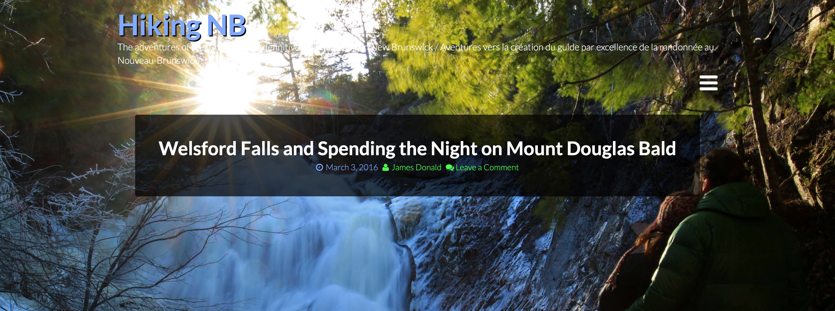
Welsford Falls and Spending the Night on Mount Douglas Bald
Other Trails in the area
- Cochrane Lane Cliffs Trail
- Mount Douglas Bald
- Blueberry Hill Nature Preserve
- Turtle Mountain Trail

Trail Last Hiked: December 7, 2019.
Page Last Updated: April 12, 2020.