Ministers Island Trails
Videos
Quick Facts
| Difficulty | easy |
| Trail Type | loop |
| Distance | 9.4 km |
| Estimated Time | 3 hours |
| Surface Type | field, old road |
| Elevation Change | 49 meters |
| Features | historic buildings, bay |
| Trail Markers | none but easy to follow |
| Scenery Rating | must see |
| Maintenance Rating | well maintained |
| Cell Reception | strong |
| Dog Friendly | on a leash |
| Fees | yes |
Gallery

Description
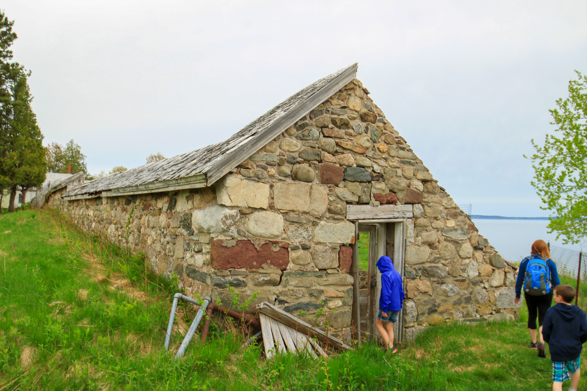
Minsters Island was named after an Anglican Minister back in the 1700's. Sir William Van Horne had a summer home on the island in the late 1800's and into the early 1900s. The large summer home (mansion), a unique circular bath house on the beach, and a large barn are still on the island. On the northern tip of the island there are remnants of Moose Manor, a cabin that was used for hunting in the 1930's. There are many layers of history on the island. The summer home, barn and other buildings are maintained as a museum for tours.
There is a trail that follows the perimeter of the island, with several other trails crossing through the fields and the forests in between. There are many views of Passamaquoddy Bay and of the shoreline of the town of Saint Andrews. You can see Chamcook Mountain in the distance from near the northern tip of the island.
The geology along the shores of the island are also interesting. There are mixes of red rocks worn with holes like swiss cheese on top of black rock that looks like someone spilled tar. There are also square rocks that flake off in sheets, and this is just on the northern tip of the island.
A brochure for Ministers Island can be downloaded here: Ministers Island Brochure.
Map
Store


Directions
From the Tim Hortons in Saint Andrews, at the Corner of Route 127 and Reed Street, take Route 127 back towards Bocabec. After 2 km turn right onto Bar Road. After another 2 km on Bar Road you will come to the shore. If it is low tide you will see a gravel bar crossing to the island. If it is high tide you will see water. Check the sign near the crossing for the crossing times.
Note: Make sure you check the tide schedule before your trip. The island can only be accessed by car at or near low tide. Information is posted at the beach near the crossing or you can get information from many of the tourist sites within the town of St. Andrews.
From the Sign
The Gardner's Cottage
The cottage was built in 1893, providing year-round housing for the gardener & his family. Generations of this family worked the gardens. It was a horticulturalist's dream, with acres of orchards, vegetable & flower gardens supplying the house daily. Groundkeeping was intensive with miles of borders to be cut along the paths. Huge lawns required cutting twice a week using a horse-drawn mower. Thirty miles of walking was required for one complete cut. Additional staff were hired for the summer months in order to keep up the increased demand.
From the Sign
The Bathhouse
Begun in 1911, completed in 1912, the bathhouse was built from red sandstone blasted from the beach below. The upper floor featured open windows & a drain hole to let out rain-water. The lower floor contains change rooms and a circular walkway leading to the outdoor saltwater pool. The panoramic view from the bathhouse inspired many of Sir William Van Horne's paintings.

From the Sign
The Windmill & Gashouse
Until electricity came to the island in the 1960s carbide gas, made in the gashouse, was pumped to the main house to provide lighting. This was a difficult operation & if not done properly belched oily soot. The windmill provided water until the well dried up & had to be relocated deep in the woods where fresh water was abundant. If the inventive Sir William was alive today he would surely be using solar & wind turbine power.

From the Sign
Moose Manor
Built around 1936
Billy (the gardener) and his wife built this cabin to use during summer and hunting season.

From the Sign
Boarding House
Built in the late 1890's
2,600 square feet
This was a two apartment style building for the workers on the farm.

Trail Last Hiked: May 22, 2016.
Page Last Updated: January 23, 2019.