Chamcook Mountain Trail
Gallery
Store

Quick Facts
| Difficulty | moderate |
| Trail Type | linear |
| Distance | 1.3 km one way |
| Estimated Time | 1 hr return |
| Surface Type | old road |
| Elevation Change | 128 meters |
| Features | peak, lookouts |
| Trail Markers | none but easy to follow |
| Scenery Rating | beautiful |
| Maintenance Rating | well maintained |
| Cell Reception | strong |
| Dog Friendly | yes |
| Fees | none |
From the Sign
Welcome to the Rossmount Historical Nature Trail
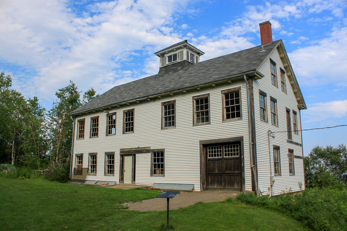
The Carriage House
For over two centuries people have visited this mountain to take advantage of the panoramic view which can be seen from the top. This is the first of a series of interpretive panels that will take you back in time as you move up the trail. The Townsend brothers of Chamcook bought the property and the original 18th century home which was called the "Mountain House". The house was supposed to be haunted by a young housekeeper who burned to death while tending to a large hearth fire. The Chamcook house became known as a haunted house. The Townsends were shipbuilders and carpenters, a very enterprising family for those days. In 1889, Jame A. Townsend of Brooklyn N.Y. decided to tear down the house and build a new private residence. The carriage house, also built in 1889, still stands today. It was said to have held two stage coaches and two four seated wagons. On November 14th 1902, Henry and Sarah Ross purchased the house and property, some 87 acres. The Ross' renamed the estate Rossmount. The Rosses made major improvements to the Chamcook property between 1910-1914 on both the interior and exterior. Plans included both flower and vegetable gardens and a duck pond with a fountain. The residence had a windmill operated water system. The estate employed four women and seven men to run the house and the grounds during the Ross' ownership. The Rosses later became world travelers and would bring their collections back to the Rossmount. It is known that the Rosses were great admirers of the outdoors, they often entertained guests for picnics and other social outings. Horse and buggy was the main source of transportation in the early days. The carriage house we see here is an example of Victorian architecture; its sound construction is the reason why it stands today. In 1945, and only eight days apart, Henry and Sarah Ross died. In 1961 the house burned to the ground. The Inn today was constucted on the original foundation, and incorporated the still-standing chimney and front steps.
Map

Description
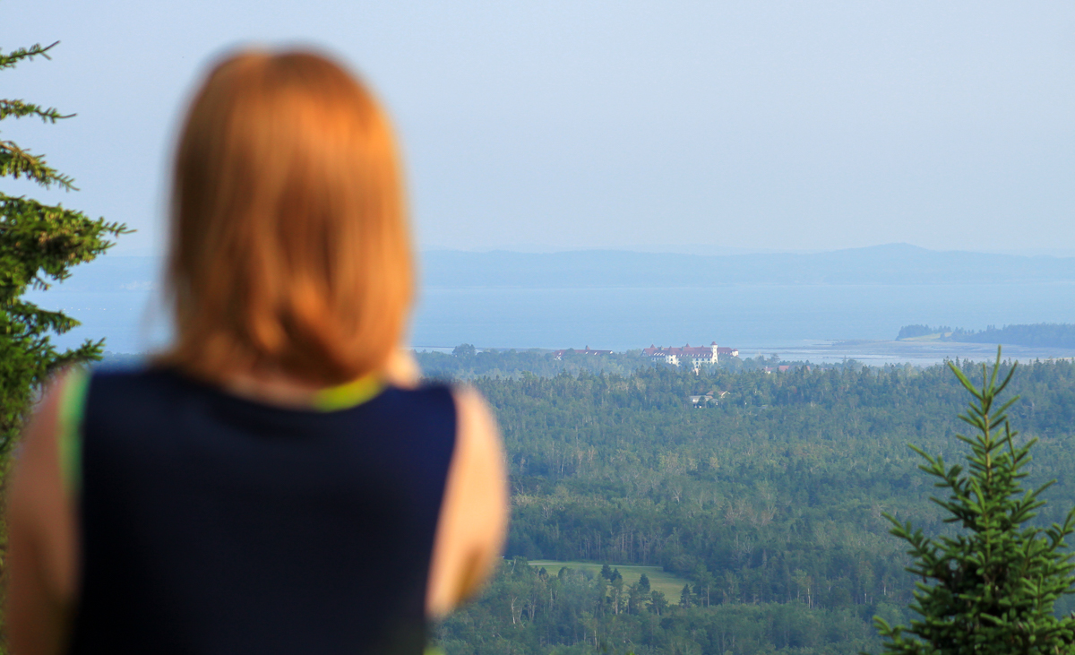
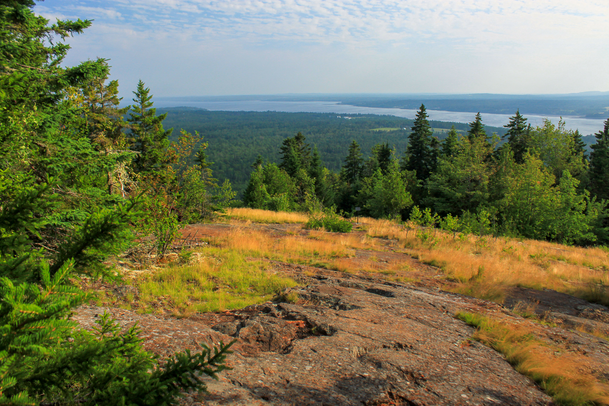
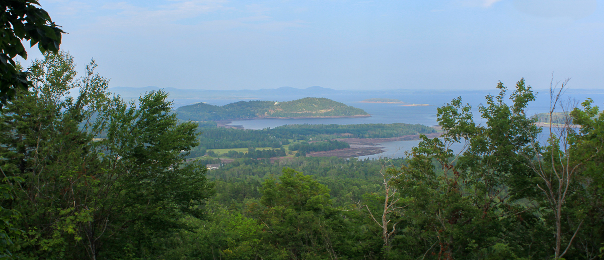
The Chamcook Mountain Trail follows a very old carriage road that climbs to the peak. Interpretive signs describe the deep history of the area. It starts at the beautiful Rossmount Inn and passes a historic carriage house. It continues along the road that was stabilized using large rocks from neighboring mountins. It passes a lookout that looks out over the islands in Passamoquoddy Bay. It then reaches the peak where you will find panoramic views of the Passamaquoddy Bay and the town of Saint Andrews.
Directions
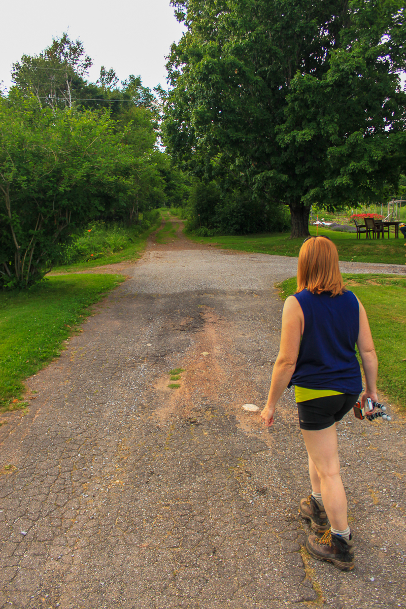
From the Tim Hortons in Saint Andrews, at the Corner of Route 127 and Reed Street, take Route 127 back towards Bocabec. After 4.4 km you should see the Rossmount Inn on the left. Turn into the driveway of the Rossmount Inn. Just before the Inn turn left and then turn left again soon after. This will take you into a parking lot.
A road climbs the hill next to the Rossmount Inn pool. Continue on this road until you reach the carriage house. From here the old road climbs the mountain.
From the Sign
The Passamaquoddy Lookout
When the Rosses constructed this trail, they did it for leisure purposes. So naturally they enjoyed the view not only from the top but also going up the mountain. As seen from this lookout, you can see the historic islands of the Passamaquoddy Bay, one of which is the infamous Hospital Island.
Hospital Island is found three nautical miles north of St. Andrews and is only tow and a half acres in size. There is nothing out there now except two foundations for buildings that once housed the sick. It has no trees, no shelter, and no water supply.
From 1815 to 1860, mainly Irish immigrants were coming to start a new life in Canada or the States. While sailing across the Atlantic in such close proximity to one another, disease would spread quickly around the boat. Once the boat would reach the harbor in St. Andrews, they would drop off all the sick on Hospital Island.
During this period of time, over 10,000 immigrants came through St. Andrews, and a total of over 400 people died on Hospital Island. Most of the people who died were from Ireland, and as a reminder of their hardships, a monument shaped like a Celtic Cross was erected on Indian Point in St. Andrews.
From the Sign
Built to Last
The stone wall, which provides structure and stability to this portion of the trail, was built between 1910 and 1914, roughly 13 years after the previous owners, the Townsends, contracted the Carriage House to be built. Frank Adams and his contracting firm, Roberts and Adams from Providence Rhode Island assisted the Rosses, Henry and Sarah, in designing and renovating the trail which sits on the wall.
It is assumed that the wall was built to widen the existing trail and to assist the common transportation at the time, horse and buggy, in climbing the mountain. There is reason to believe that the stones were quarried from Greenlaw Mountain, which you can see from the top of Chamcook Mountain, and hauled up the trail using oxen and a primitive model sled hauled on a flat base.
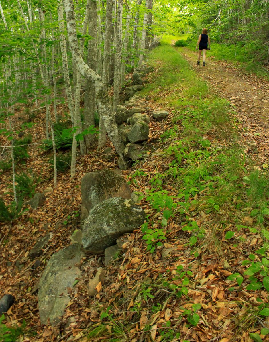
All of the work allowed the Rosses, the local aristocrats, and outdoor enthusiasts to travel the trail so they could see the view from the top.
As you make your way up the mountain, watch for the rock wall as it can be found along a great portion of the trail, helping ensure that people can enjoy this trip for years to come.
From the Sign
Stepping Back
Before the Ross family acquired Chamcook Mountain, a rich history had evolved in this area. From 1850 through 1860, the American government worked towards the completion of mapping the Eastern Seaboard. Chamcook Mountain was one of the last sites used by the Americans to survey the coast and was chosen because of its superior visibility. If you look around at the top, you may still see holes in the rock where survey equipment was anchored.

As you look out towards the town of St. Andrews you will see Navy Island. Formally known as Fletcher Island, it was first populated by Natives and used as a trading post. After settlers moved into St. Andrews they then named it St. Andrews Island. The British Navy were the only ones allowed to use the Island (Hence the name Navy Island) for docking and repairing their masts, as they were tall and straight, unlike the trees there today.
In 1604, French explorer Samuel de Champlain sailed up the mouth of the St. Croix River and helped establish a colony on Dochet's Island, now known as St. Croix Island (an international historic site) near the river's mouth. He named the river St. Croix due to its three rivers that branch off and form an irregular cross. Of the 79 men who attempted to overwinter on the island, only 40 survived due to the harsh conditions and scurvy. The island was then abandoned in 1605.
From the Sign
What a Beautiful View
It is easily understood why Chamcook Mountain was such a popular setting for picnics. The view we have here from the top of the mountain is quite extraordinary to say the least. So much so that the influential Bostonians and New Yorkers would often come and picnic here with the Rosses. A person was very fortunate to get an invitation to picnic at the top of the mountain. A favorite pastime was to carve one's initials into the smooth rocks here at the top of the mountain. The earliest initials recorded were dated 1784 and were surrounded by a heart with the initials A.W.W. and H.E.W. Almost all the smooth rocks were inscribed. It was very nostalgic for people to return to the mountain years later to look for their initials.
Unfortunately the rocks were sandblasted by one of the previous owners of the Rossmount Hotel and the mountain, removing the earliest inscriptions.

Ross Memorial Museum (RR 92.1458.13)
Other Trails in Saint Andrews
Trail Last Hiked: July 26, 2014.
Page Last Updated: April 5, 2019.