Simpson Hill Trails
Videos
Quick Facts
| Difficulty | moderate |
| Trail Type | mixed |
| Distance | 2.5 km mapped |
| Estimated Time | 1 hr return |
| Surface Type | forested, rocky |
| Elevation Change | 119 meters |
| Features | peak, bay |
| Trail Markers | orange ribbons and signs |
| Scenery Rating | beautiful |
| Maintenance Rating | well maintained |
| Cell Reception | strong |
| Dog Friendly | yes |
| Fees | none |
Gallery

Description
The Simpson Hill Trail system is a short, intricate trail system that climbs to a granite outcrop called Table Top. From Table Top you can see the beautiful Oak Bay and the surrounding landscape. The trail travels through several different forest types like pine near the peak, hardwood in the lowlands, and softwood to the south. There are also many interesting features to explore such as Hidden Valley, a deep rocky ravine, and Karen's Cache, a rocky overhang underneath Table Top.
We have not yet had the chance to map out all of the inticate trails that make up this system. The following is a map of the existing trails. For a higher resolution version of the map click on the map below.
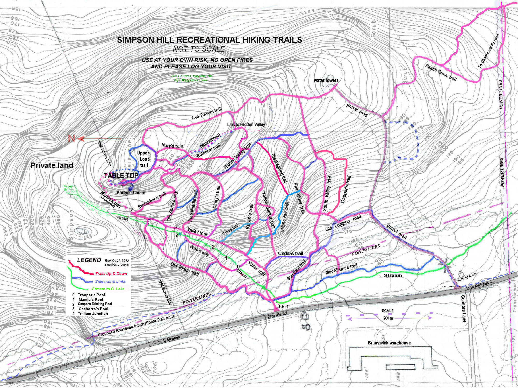
Map
Store


Directions
Take exit 25 on Route 1 and turn towards St. Andrews. After 5.6 km look for a life sized cut out of a girl along the road on the left. Park along the road and enter the woods next to the girl. This is a high traffic area so be careful while parking and crossing the road.
There is a plan to build a parking area at the entrance to the water tower road. To find the water tower road continue for another 300 meters and find the road on your left.
Other Trails near Saint Andrews
Trail Last Hiked: June 2, 2018.
Page Last Updated: April 6, 2019.