Gold Trail (Bell Flats
Meduxnekeag Valley Nature PreserveGallery

Store

Quick Facts
| Difficulty | easy |
| Trail Type | loops |
| Distance | 2.4 km |
| Estimated Time | 1 hour |
| Surface Type | forested |
| Elevation Change | 22 meters |
| Features | river, forest |
| Trail Markers | gold posts |
| Scenery Rating | beautiful |
| Maintenance Rating | well maintained |
| Cell Reception | weak |
| Dog Friendly | on a leash |
| Fees | donations accepted |

Map
Directions
From Route 2 in Woodstock take exit 185 to Connell Street. Head west on Connell Street (Route 550) for 3.5 km and turn left on to Red Bridge Road. After 4.8 km on the Red Bridge Road you will come to a bridge crossing the Meduxnekeag River. Turn right onto Bell Settlement Road just before the bridge.
Travel for 4.2 km on Bell Settlement Road. You will find the sign for Bell Flats on your left. The trail is next to the sign.

Description
This trail was developed in the summer of 2016. The trail starts at a chain link fence and goes into the woods on the right and left. Going right it follows an old road parallel to Bell Settlement Road then turns left away from the road. It travels through a mature fir forest where the roots of the trees are laid bare.
A large rope is used to help descend a small hill. The trail then comes to a junction. Turning left will take you along another old road that travels through a mature red pine plantation. The red pine plantation is interesting because a stream has diverted through the stand and killed the trees along this new stream bed.
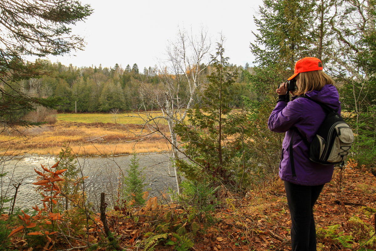
The trail then comes to another trail junction near the river. Turning right takes you along the cliff tops on the Meduxnekeag River. The trail soon comes to small clearing overlooking the river. The trail travels along the cliff tops for a short distance before going back into the woods to go around some large sink holes. The trail then returns to travel along the cliff tops once again. The trail then turns back into the woods and soon meets up with the first junction.
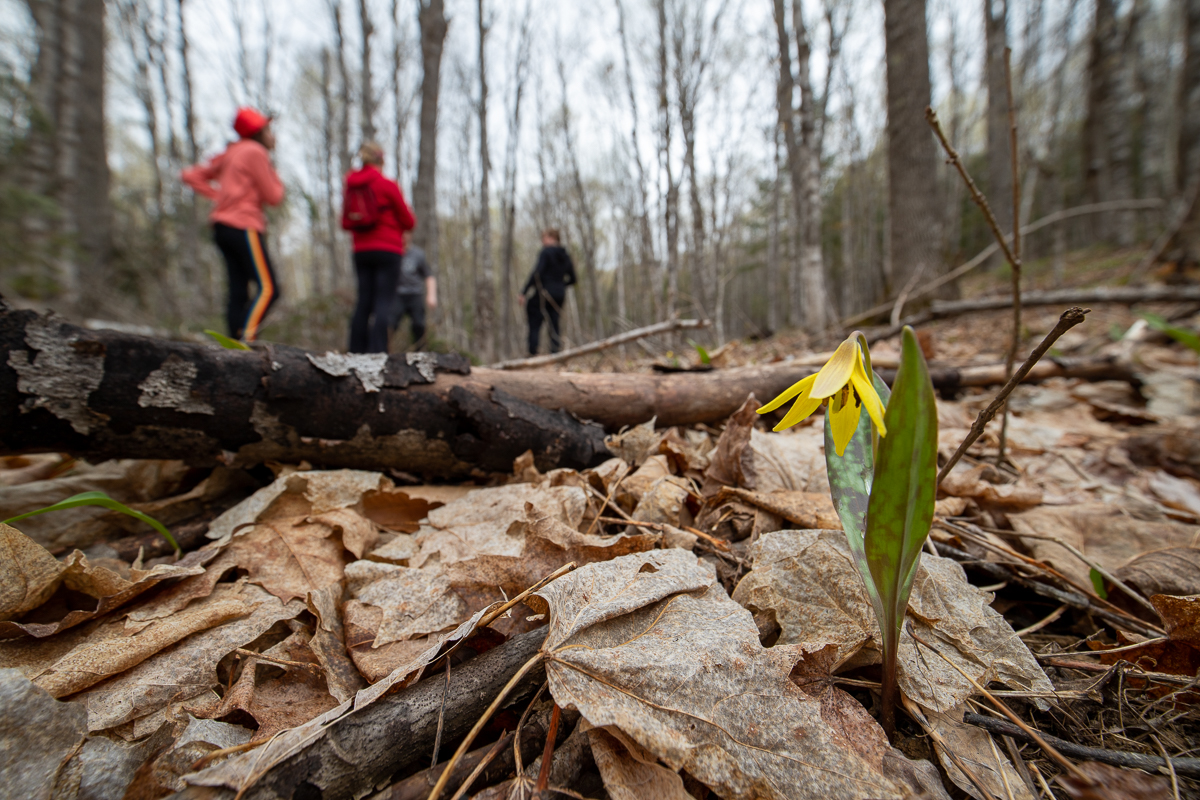
Turning left at the junction near the river will take you to a bench at a lookout looking up the river. The trail then loops around a mainly hardwood forest going back to the start of the trail. If you are here the right time of year you will find lots of wildflowers. There are many interpretive signs on this trail describing the surrounding forest, plants, and animals.
From the Sign
Welcome
Welcome to the Meduxnekeag Valley Nature Preserve Bell Flats Property, home of the LUSH Education Loop, named in honour of the trail's major sponsor, LUSH.
The goal of the LUSH Education Loop is to emphasize how different forestry practices affect the biodiversity of the trees, creatures and plants that make up the forest. To demonstrate this, we have created educational plaques using recycled and reused materials that will help you identify different understorey plants, forest types and previous uses of the land. To further reduce our environmental impact, we specifically placed our trail on old harvesting and skidder roads as well as game trails where few trees and understorey plants grow. For more information on the plants, animals and trees that you see, or to share pictures you take while exploring the loop, please visit our website at www.meduxnekeag.org.

Bell Flats
Bell Flats is a property originally cleared for farm land and then later planted with Balsam Fir for Christmas trees, Black Spruce for lumber and Red Pine for power poles. Before being purchased by the Meduxnekeag River Association in 2014, this property was owned and farmed by the same family since the 1800s.
Although Bell Flats lacks the vast diversity found within its sister property Bell Forest, it is very important habitat for mushrooms that thrive in the slightly acidic soil, and animals such as white-tailed deer, porcupines, and raccoons who find shelter beneath its needled canopy during winter months. Most mushrooms have a very short and specific season, keep your eyes open for these unique forest species. Bell Flats connects the How Project Preserve and Bell Forest, providing a continuous forested habitat and travel corridor for a variety of species. All three preserves have riparian frontage along the Meduxnekeag River protecting the shoreline.
From the Sign
Meduxnekeag Watershed
A watershed is an area determined by topography that determines where the water will flow. When there is precipitation (rain, snow, sleet, etc) in the Meduxnekeag Watershed, this precipitation will eventually make its way to the Meduxnekeag River if not absorbed, used or evaporated first. Here is a map of the Meduxnekeag Watershed, it is approximately 900 square km but only 1/3 of the watershed is actually in Canada.
Of the Meduxnekeag watershed in Canada, 90% of it is owned by private land owners.
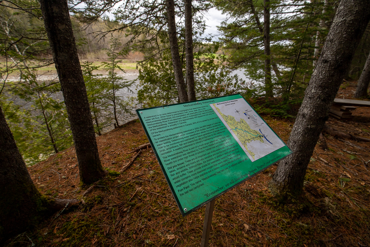
To protect the Meduxnekeag watershed in 2004, the MRA began a 3-year water classification project which consisted of fish studies, benthic studies and water testing. Determining water classification allows the overall health of the river to be monitored and maintained for future generations of people, animals, birds, amphibians, fish and insects that rely on the river for life, habitat and recreation. A healthy watershed is critical in maintaining biodiversity.
The Meduxnekeag River is part of a much larger watershed. The Saint John River watershed was identified by The World Wildlife Fund as being in good health but under high threat of pollution, habitat loss and fragmentation.
Did you know: Trees are an important part of the watershed - The edges of lakes, streams and rivers are very sensitive and are the most active areas for fish and wildlife. Without trees, the diversity of wildlife in lakes and wetlands would suffer. Trees provide shade for waterways, keeping them cool. Cool water contains more dissolved oxygen than warm water. Trees and other vegetation also helps stabalize soil in banks, reducing the risk of erosion.
Fun Fact: The name "Meduxnekeag" has had over 25 different spellings over the last two centuries!
"Remember, we all live down stream. Respect your waterways."
From the Sign
Balsam Fir Trees
(Abies balsamea)
Plantations of Balsam fir trees are found throughout New Brunswick because of their retail use as Christmas trees. This Christmas tree plantation has grown beyond commercial use. As the Balsam fir trees die, decompose and create opening in the canopy, the area will begin to naturalize allowing other plants and eventually trees to grow.
Balsam fir trees are a short-lived species with an average life expectancy of only 80 years.

Fun Fact: Balsam Fir trees are New Brunswick's provincial tree.
Did you know: Balsam Fir sap is used to mount species to slides observed under a microscope.
From the Sign
There are many more interpretive signs throughout this trail. You can find pictures of them in the Gallery.
Other Trails in the Park
External Links
Trail Last Hiked: May 18, 2019.
Page Last Updated: May 4, 2020.