Petitcodiac Dykeland Trails
Gallery
Store
Quick Facts
| Difficulty | easy |
| Trail Type | mixed |
| Distance | 6 km |
| Estimated Time | 2 hrs |
| Surface Type | cruched rock, old roads |
| Elevation Change | 51 metres |
| Features | river, ponds |
| Trail Markers | none but easy to follow |
| Scenery Rating | beautiful |
| Maintenance Rating | well maintained |
| Cell Reception | strong |
| Dog Friendly | yes |
| Fees | none |
Description
The Petitcodiac Dykelands Trail was more than I expected. I always saw the short trail around the small pond and thought it ended there. When I finally stopped to check it out I found that it was much more. There is a small island in the pond that has an area dedicated to bees as part of an education project. Beyond the trail around the pond, the trail crosses a bridge over Gray Brook. This is the same brook that flows over the dam at the Gray Brook Marsh and Wetlands Trail.
After the bridge the trail splits into another loop. This loop goes around an open field that looks like it was previously used as a place to pile gypsum. Going straight on the loop takes you past another smaller pond. Turning left will take you along Gray Brook. At the end of the field the trail takes a sharp right turn and travels along the top of a berm flanked with Aspen trees. On the far side of the loop the trails come together on an old road.
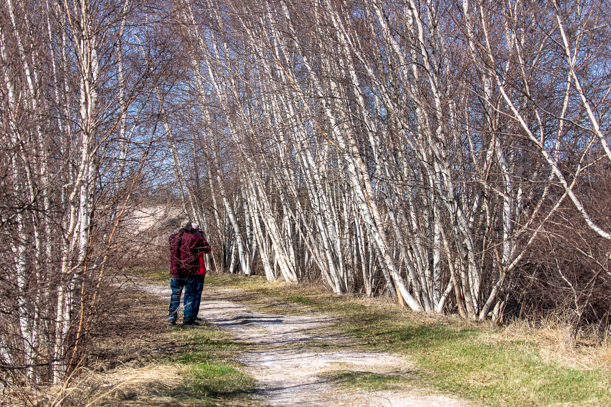
The old road winds further into the fields and soon comes to a pond that is larger than the first two. Here you should see lots of ducks. On my visits I saw Ringed-neck ducks, mallards and Northern Shovelers. You will also see lots of songbirds in the young birch that line the trail and pond.
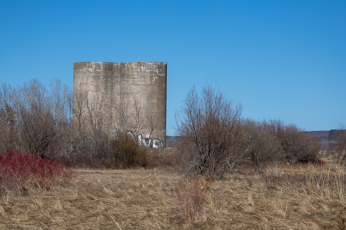
At the far end of the pond the trail splits. The trail to the right takes you out to the main dyke along the Petitcodiac River. The trail accesses the dyke near two large silos that were used for shipping gypsum. Once up on the main dyke you can follow it to the right for over a kilometre.

If you continue left at the pond you will continue around the pond The trail splits again. Both trails go out to Steeves Street. The trail to the left crosses the street and travels back along the street towards the start. When the trail crosses back over the street it will follow Gray Brook and pass by a parking lot. The parking lot and adjacent field is used by the local model airplane club as a launch site. The trail drops down through a small valley before coming back out on the second loop. Turn right and you will return to the first pond and the start of the trail.
Don't forget to check out the train museum across the road from the start of the trail.
Map

Directions
If you are coming from the Moncton direction, drive through Hillsborough and you will come to an intersection near the colored shops and power station. At this intersection turn left onto Steeves Street (If you are coming from the Alma direction turn right onto Steeves Street).

Just past the shops you can park on the right. If there isn't enough space you can park across the road at the train museum. The trail starts between Steeves Street and the pond, just past the Visitor Information Centre. You can also access the trail at several places along Steeves Street.

Trail Last Hiked: April 23, 2022.
Page Last Updated: December 18, 2022.