Lower Joslin Falls Trail
Gallery
Quick Facts
| Difficulty | difficult |
| Trail Type | linear |
| Distance | 164 metres |
| Estimated Time | 15 minutes |
| Surface Type | forested |
| Elevation Change | 44 metres |
| Features | waterfall |
| Trail Markers | none |
| Scenery Rating | beautiful |
| Maintenance Rating | moderate |
| Cell Reception | strong |
| Dog Friendly | yes |
| Fees | none |
Video
Description
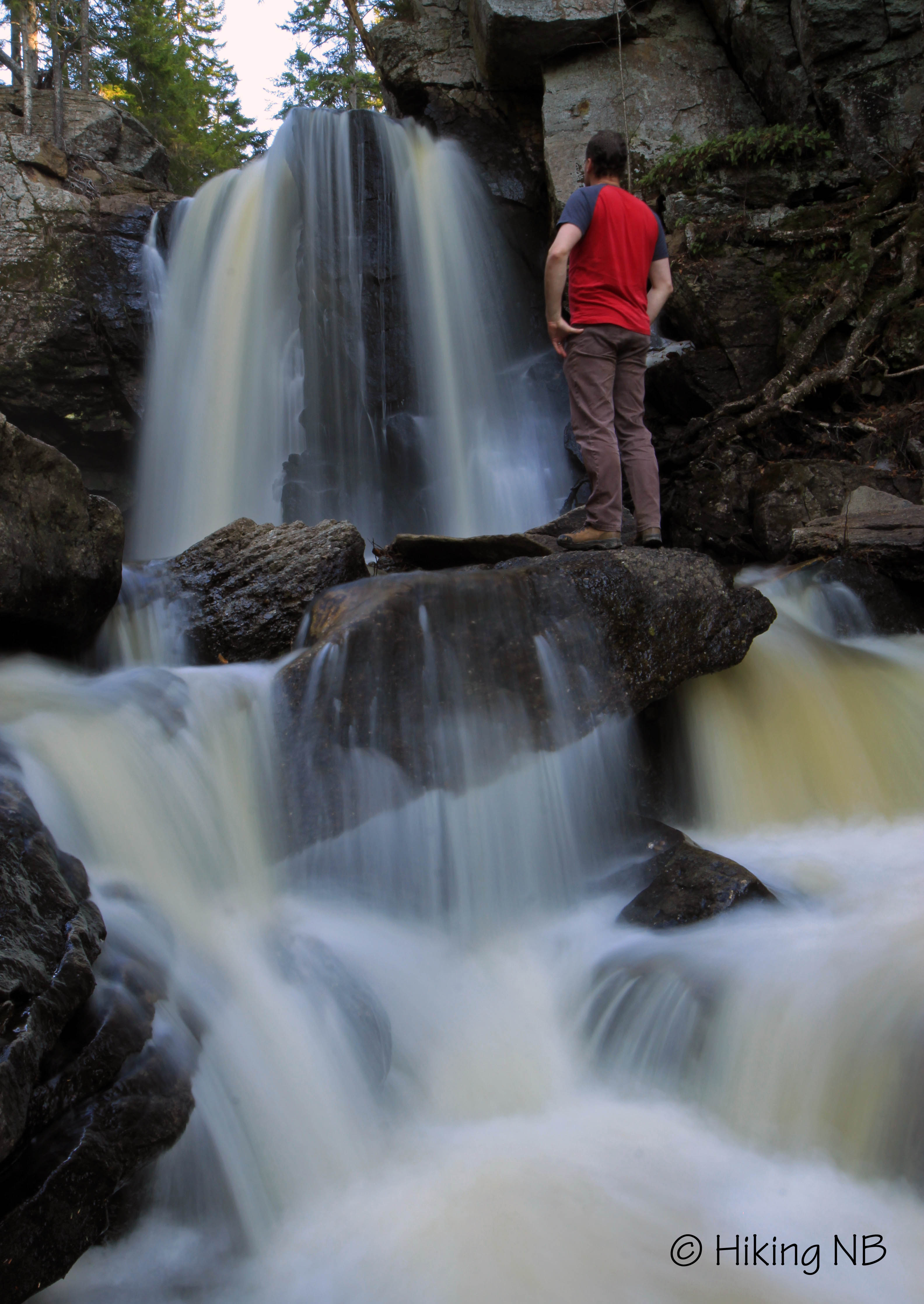
From above you can see where the water drops over the edge but you can't see the falls. There is a flatter area on the other side of the stream where there may be a better view. I couldn't cross the stream without getting my feet wet so I stayed on one side. There is a small hill to climb when entering the woods at the top of the falls. After a short distance you will come to a cliff edge and the valley opens up below. You still can't see the falls from this angle but you see the depth of the valley that holds the falls.
The trails continue along the top of the cliff edge. I am assuming there is an easier way down if you continue on these trails but I took the more direct route down. Climbing down over the cliff is difficult but there are several small and large trees to grab. At the bottom you see the shear face of the falls plunging into a bould pile. There are many large boulders that at some point had fell off the cliff face. They make a sort of shelf at the bottom of the falls. The water plunges through these boulders in many different spots.
On the other side of the falls and stream there are interesting terraced cliffs and small caves to explore. The rocks are covered in small ferns that seem to dance in the wind and the spray from the falls. The video linked below explores the cliffs.
Map
Store

Directions
From the Fredericton direction drive past the exit to Kings Landing. Travel past the exit for another 3.6 km. Park just past the long guardrail on Waterloo Brook by the 250 km marker sign.
Walk at a angle back towards the stream and towards the deer fence. You will find a deer gate on you left. Go through the deer gate and turn right towards the stream. Before you go over the small hill to the stream you should find small trails going into the woods on your left. Follow these small trails and you will soon come to a cliff. You can climb down this cliff into the basin below the falls. There are also small trails following along the cliff edge to your left. They may take you to an easier way down but they have not yet been explored. Be cautious climbing down.
Other Trails in the Area
External Links
Trail Last Hiked: May 3, 2015.
Page Last Updated: May 9, 2015.