Millbank Nature Trails
Gallery
Store
Quick Facts
| Difficulty | moderate |
| Trail Type | mixed |
| Distance | 6.1 km |
| Estimated Time | 2 hours |
| Surface Type | forested |
| Elevation Change | 52 metres |
| Features | forest |
| Trail Markers | red circles |
| Scenery Rating | recreational |
| Maintenance Rating | well maintained |
| Cell Reception | strong |
| Dog Friendly | yes |
| Fees | none |
Description
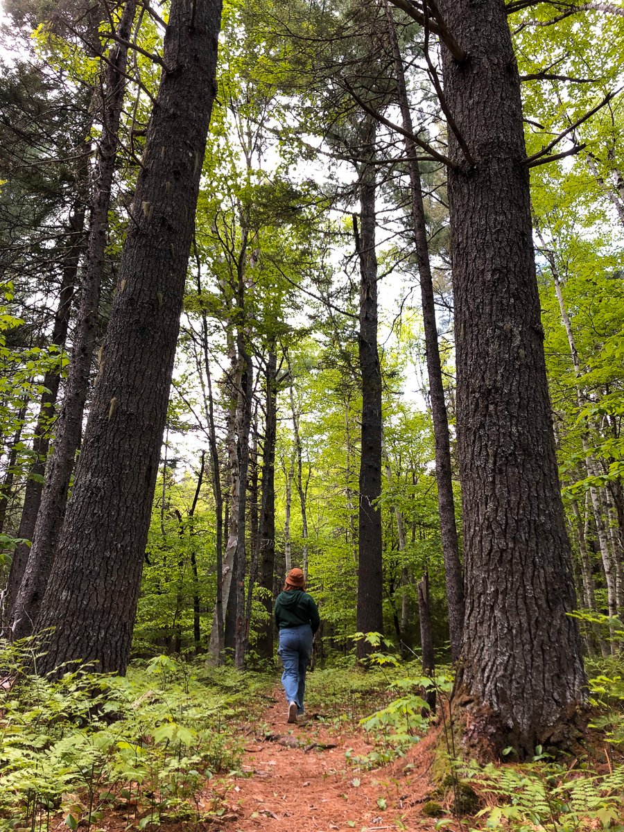
The Millbank Nature Trail system has three main sections. The southeast, the southwest and the northwest sections of the trail system each have unique habitats and features.
The southeast section starts with a short walk on a sandy road that runs along a jack pine plantation. The trail leaves the road on the right and soon passes a sign showing the way to Elephant Rock. Not far past the sign you will come to an old outhouse on the right. The trail travels through a small patch of large white pine trees then transitions into more of a mixed spruce and fir forest. The trail dips over a small hill into a stream valley. At the bottom of the hill there are old benches along the trail made out of old white pine logs. At this point if you look into the woods to your left you will find the moss covered Elephant Rock. It sounds like it's easy to find Elephant Rock but read our blog post to learn about how it took us 3 years to find this rock!

Continuing on past the benches you will cross several wooden pallets that were placed along the wet parts of the trail to help keep you dry. After crossing a small bridge over a beautiful little stream the trail turns left. The trail follows along the bottom of a hill at the other side of the stream valley. The trail here is also quite wet from springs coming out of the hill. There are also small sections of old wooden pallets here but they are rotten and not safe to use. It is not difficult to make your way around the wet spots. After a short distance you will come to a collapsed old bridge that used to take you back over the stream to a small play area with a swing set. The swings and bridge were both damaged beyond repair on our last visit in 2013. Continue past the bridge and you will climb up the hill and out of the stream valley. The trail is dryer up on the hill. The forest is dominated mainly with spruce and white birch up on the hill.
You will eventually come to an old road. This is the same old road that you started on and can be used to make a loop back to your vehicle. If the road is very wet you may want to stick to the trail since the road can be quite muddy between here and the parking area. Turn left on the road and cross back through the stream valley. You may notice that the stream crosses the road by flowing through a unique culvert made from old barrels. Just past the culvert on the left is a small picnic area with a unique picnic table and benches made out of small tree trunks. It is in a beautiful little area next to the stream.

The main trail continues across the road from the picnic area. Shortly after entering the woods the trail splits. The trail to the right will take you to the spring where you will find an old collapsed shed that used to cover the spring. Do not go any further past the spring. Although it looks like the trail continues past this point it was impossible to follow when we tried. Go back to the trail junction and take the trail to the left if you want to continue exploring.
The trail continues cross country. It crosses several different aged mixed forest types and old roads that have grown in. After about a kilometer you will come to a split in the trail marked by a sign and a unique seesaw made out of old logs and pvc pipe. The south-west section of the trail starts here.
The southwest section of the trails can be accessed in 3 ways. Either from the trail coming in from the south-east section, the entrance on McHardy Road, or the entrance near the gate to the power point. The southwest section is basically a large loop split in the middle by the trail coming from McHardy Road. The forest type here is dominated by large white pine with smaller white birch underneath. There is a picnic area where the McHardy Road entrance trail crosses the loop trail. At the picnic area there is an outhouse and a unique picnic table that is built around and old tree. The picnic table is damaged but is still usable on 3 sides.

The northwest section of the trails is accessed across from the entrance to the south-west section near the power plant gate. The northwest section of the trails forms a large loop with a short trail splitting the loop near the middle (see map). The trail is mainly dominated by large pine near the road but changes into a more mixed hardwood forest with a mix of spruce. The western part of the loop comes out to McHardy road and follows an old overgrown road for a short distance. The eastern part of the loop travels a short distance along the power lines leaving the power plant, and at one point comes to the fence around the plant. There are a few places near the entrance where the trail is a bit difficult to find but once you figure out the start you should have no problem.
Map

Directions
There are 3 main entrances to the Millbank Trail system. The north-western most entrance to the trail system is near the entrance to the Millbank Power Plant. From the Centennial Bridge in Miramichi head north on route 8. After 5.6 km turn right onto McHardy Road and then turn left onto the power plant access road after another 850 meters. About half way (300 m) to the power plant gate you will see a large welcome sign on the right. There is plenty of space to park here along the road. The trail enters the woods on both sides of the road.

The second entrance to the trails is further down McHardy road. At 450 meters past the power plant access road you will see a large welcome sign and a bridge on your left.
The third entrance to the trails, and what seems to be the least maintained section of the trails, is off the Old King George Highway. From the Centennial Bridge head north of Route 11 towards Tracadie-Sheila. At just over 4 km you will see the other end of McHardy Road on your left (You can also access the other two entrances to the trails from this direction). Continue past McHardy road for another 1.5 km and you will come to the city limits sign. Just before the city limits sign on your left you should see a gravel road. Enter the narrow gravel road and you will soon come to a small parking area. Park here and walk up the road for 280 meters. On the right you will find the start of the trail.
Trail History
We began our visits to Millbank Nature Trails back in 2010. At that time many of the structures or man-made features we found along the trail were in disrepair. The good news is that over the last couple of years a group of volunteers have been replacing entrance signs, bridges and picnic tables. We would like to thank all the volunteers that have brought this trail system back to life and keep it maintained.

Other Trails in the city
External Links
Trail Last Hiked: June 4, 2022.
Page Last Updated: December 3, 2022.