Red Point Trail
Video
Quick Facts
| Difficulty | easy |
| Trail Type | linear |
| Distance | 2 km one way |
| Estimated Time | 1 hour 15 mins return |
| Surface Type | boardwalk, crushed rock |
| Elevation Change | 9 meters |
| Features | coastal views |
| Trail Markers | none but easy to follow |
| Scenery Rating | beautiful |
| Maintenance Rating | well maintained |
| Cell Reception | medium |
| Dog Friendly | on a leash |
| Fees | none |
Gallery
Description
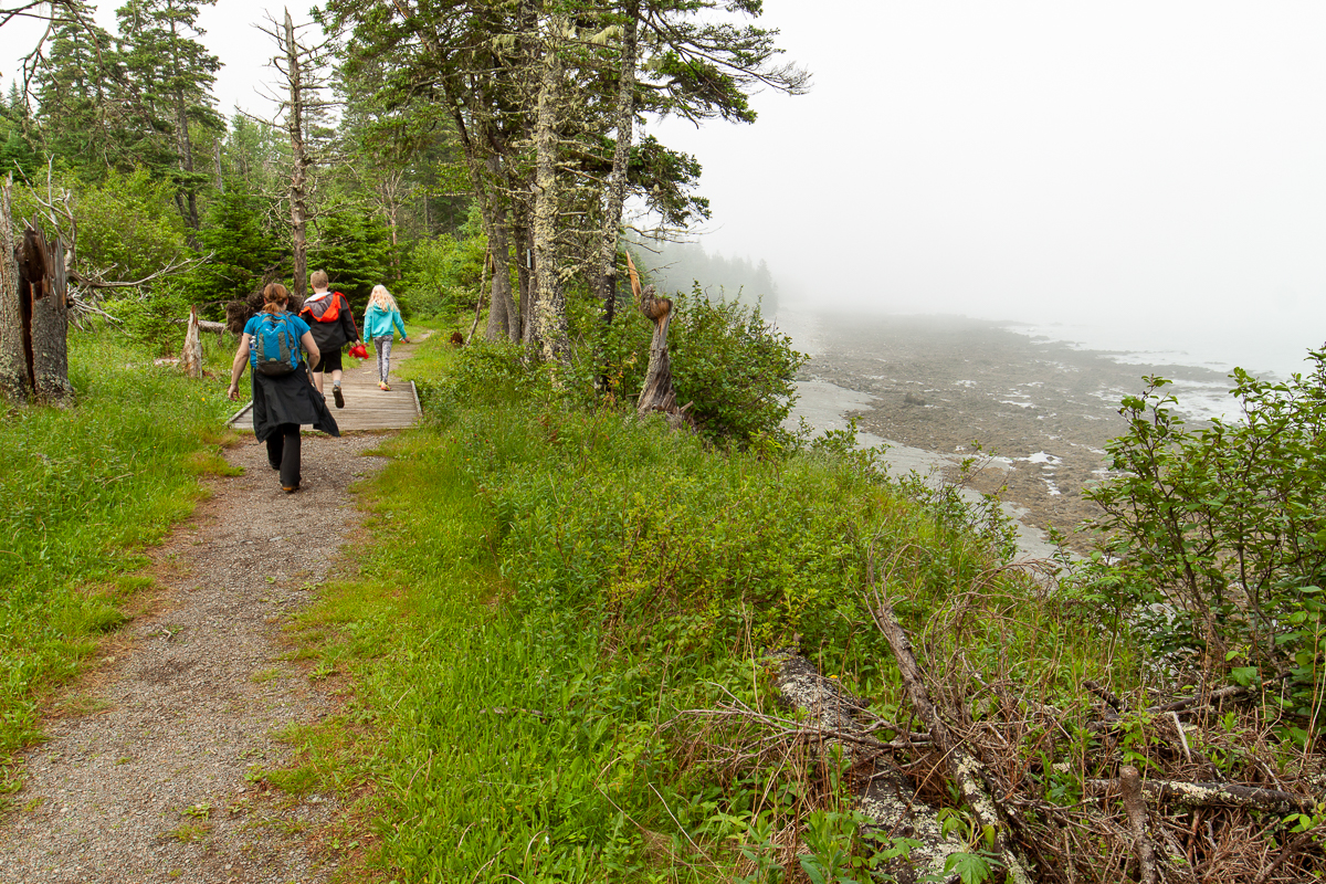
The Red Point Trail starts as a long straight grassy trail. It soon passes a large monument on the left dedicated to all of the fishermen from the island who have lost their lives. After passing the square cement outline of an old building the trail turns to crushed rock for a short distance. The trail then turns into a boardwalk, which can be extremely slippery when wet. To help with this issue shingles have been nailed to the boardwalk to provide grip.
Shortly after the start of the boardwalk the trail comes to a junction. Turning right will take you through the woods to the campground. Keeping straight will continue on the trail along the cliff tops. There are several interpretive signs along the trail. One explains the history or shorebird egg harvesting in the area. Another describes the sealife that can be found amongst the rocks on the shore. Another at the end of the trail explains how a nearby cement pillar is used as a reference point to help the accuracy of the GPS satellite network used for navigation.
There are several lookouts along the trail overlooking the ocean and the surrounding islands. In some places the trail comes close to the cliff edge and is marked with danger signs. There are several benches that look like giant lobster traps. The trail travels through a mainly spruce coastal forest, which can be wet in places and is therefore the reason for the boardwalk. Near the end of the trail the forest opens up into what looks like an old field that has grown up in alder bushes.
Map
Store


From the Sign
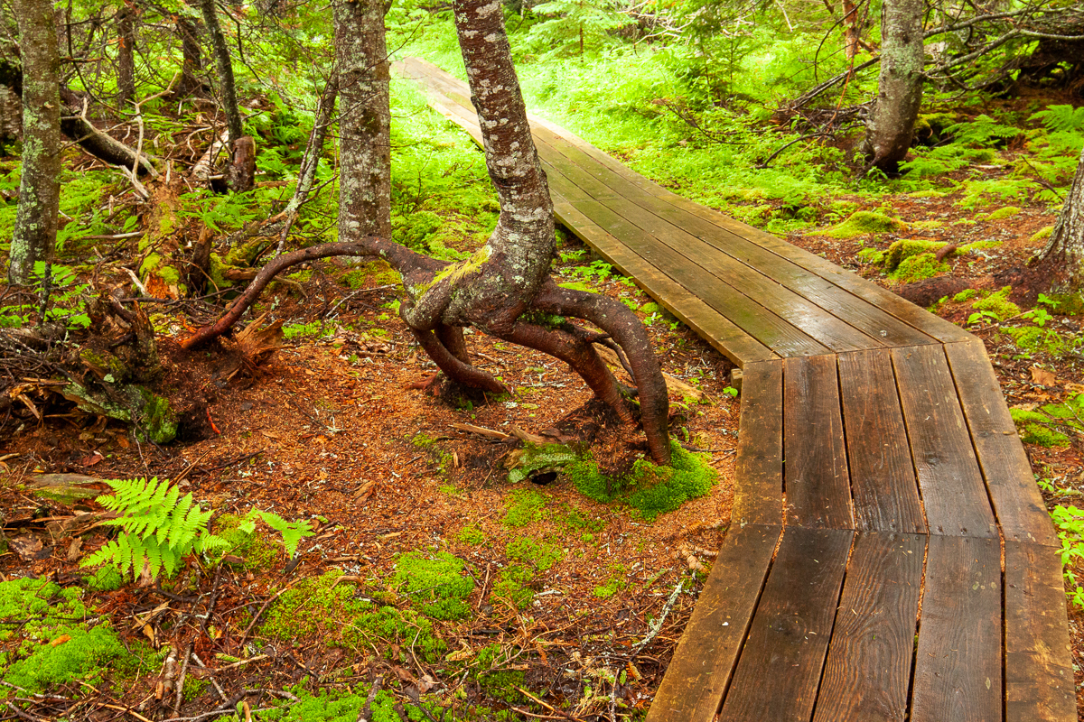
TREES ON STILTS
This huge old stump has become home for several trees. Seeds fell in the moist rotting wood and started to grow, their roots extending down the stump ad into the soil. Eventually the stump will fall apart and the spruce, yellow birch and mountain ash will be left standing high above the ground on these stilts.
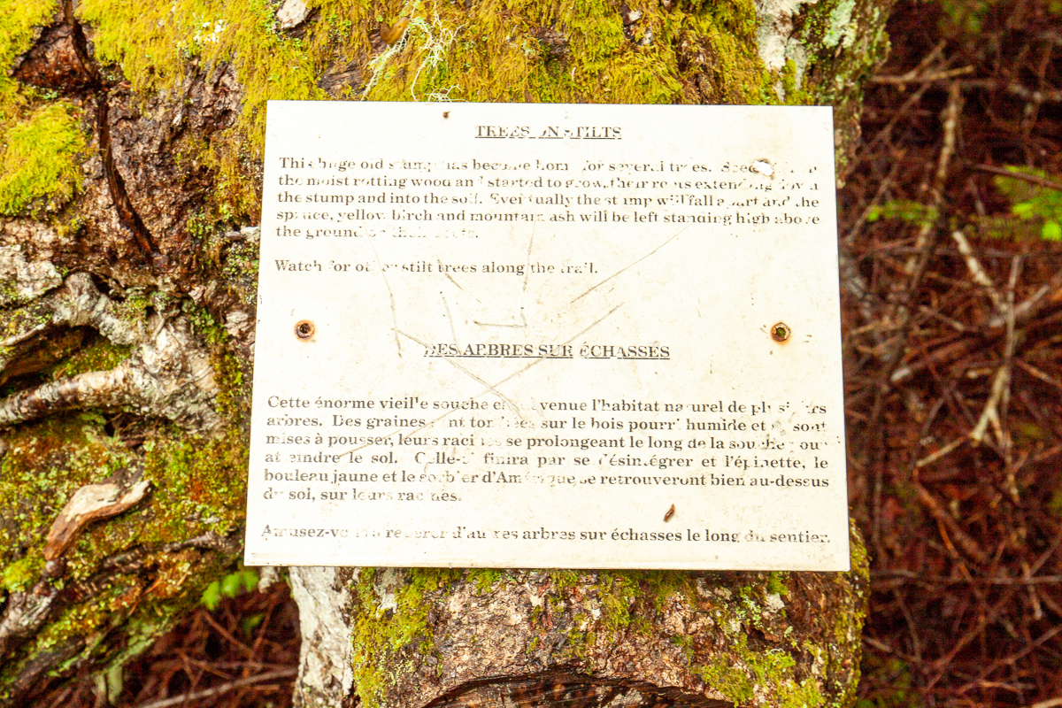
Watch for other stilt trees along the trail.
Directions
For directions to the park go to the Anchorage Provincial Park page.
Enter the main entrance of the park and stay left on Long Pond Road. At the end of Long Pond Road you will come to a junction just before the beach. Turn right and park in the parking lot. Cross the small field near the shoreline and you will soon see a gate that marks the entrance to the trail.
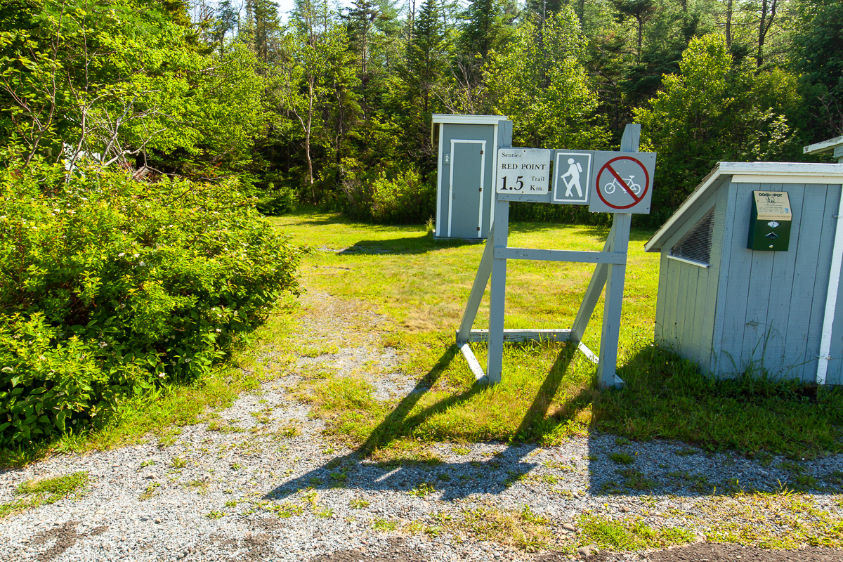
Another access point for the trail is at the back of the campground. Enter the main entrance of the park and keep right to access the campground. After entering the campground turn right to enter the main campground loop. Travel around the loop to the opposite side along the woods. Look for the bathroom and a shelter. The trail starts next to them.
The third way to access the trail is from the Red Point Road. Continue past the park and turn right onto the Red Point Road, just before you enter the town of Seal Cove. At 1.7 km the road turns to the left and then back to the right. On the turn you will find a small parking lot on the left. The trail starts from this parking lot.
From the Sign
A ROCKY SHORE
Walk carefully along the beach at low tide. The wet area is called the intertidal zone. Here, you may discover many different sea plants and animals. Most intertidal animals hide among the slippery rockweeds. As the tide rises, animals such as Periwinkles, Starfish and Green Crabs will emerge from under the shelters to feed on the microscopic plant life stirred up by incoming waves.

SURVIVING DIFFICULT CONDITIONS
As the tide moves in and out, the intertidal zone regularly experiences sudden changes - extremes in temperature (hot or cold), wind instead of waves, and a new set of predators. These small organisms must be tough to survive.
Trail Last Hiked: June 24, 2017.
Page Last Updated: September 3, 2021.