Long Falls Trail
Gallery

Store
Quick Facts
| Difficulty | moderate |
| Trail Type | linear |
| Distance | 200 metres one way |
| Estimated Time | 15 mins |
| Surface Type | forested |
| Elevation Change | 31 metres |
| Features | waterfall |
| Trail Markers | none, GPS skills required |
| Scenery Rating | beautiful |
| Maintenance Rating | well maintained |
| Cell Reception | none |
| Dog Friendly | yes |
| Fees | none |
Directions
Caution: It's best to use a GPS for this one to make sure you are on the right forestry roads. Also use caution (especially if going during the week). These are active forestry roads so you may meet loaded pulp trucks.
If coming from Fredericton, continue on Route 104 past the turn off to Crabbe Mountain ski hill. Continue down a long hill towards Millville. After 3 kilometres from the turn off to Crabbe Mountain you will find a junction with a wide gravel forestry road. Turn right on this forestry road.
Drive for 8.4 kilometres and you will come to a major split in the road. Continue on the road up the hill to the left. You will soon come to a sharp turn to the left and then another sharp turn to the right. At just under 20 kilometres from the road split you will find a road that runs parallel to the main road on the left. Just past this you will find another road on the left (in better shape) that turns back and meets up with the parallel road. Both of these roads provide access to a side road. Drive on this side road for 5 kilometers and look for a road on the right.
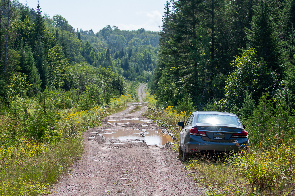
The last section of road gets rough with lots of large puddles. Drive for 3.3 kilometres on this road, or as far as you are comfortable going with your vehicle. The road will descend a long hill. About half way down this hill look for a rough ATV trail entering the woods on the left. This marks the start of the trail into the falls.
Note that it's only about 12 kilometres from the pavement in Cloverdale to the last turnoff to the falls. I tried to leave this way on my last visit and came to a deep mud hole in the road that was impassable by car. It may be possible to take a truck through it but it looked like it was mostly used by ATVs.
Map

Description
The trail starts as a rough ATV trail but it looks like ATV's just turn here and don't continue. The trail is a rough, wet trail down to the pond below the upper falls. The trail continues below the pond and soon comes to a bridge crossing the stream. On the other side of the stream are several small camps. Continue past the bridge (without crossing it) and you will soon come to the larger lower falls below the camps. On my visit I didn't realize the lower falls existed so I spent all my time exploring the upper falls and swimming in the pool.

The upper falls first cuts through a crack in the rock with high cliffs on either side. The valley opens up into a wedged shape opening that has a small pool before pouring through another narrow crack in the rock to the larger pool below. The rock near the lower falls is worn smooth from the flow and is a bright orange in color. This contrasts nicely with the surrounding gray cliffs and green, mossy slopes. The pool at the bottom is larger and makes a perfect place for a swim.
From the pictures I can find online the lower falls is much larger and flows over a rounded granite face, in three large tiers, into another pool below. I definitely have to go back and see the lower falls.

Map
Other trails nearby
Trail Last Hiked: August 14, 2021.
Page Last Updated: December 25, 2021.