Spooner Island Rotary Park Trails
Gallery
Quick Facts
| Difficulty | accessible |
| Trail Type | mixed |
| Distance | 1.9 km one way |
| Estimated Time | 1 hr 15 mins return |
| Surface Type | crushed rock |
| Elevation Change | 11 meters |
| Features | ponds |
| Trail Markers | signs |
| Scenery Rating | beautiful |
| Maintenance Rating | well maintained |
| Cell Reception | strong |
| Dog Friendly | on a leash |
| Fees | none |
Podcast
Episode 6: The History of Spooner Island
Description
Spooner Island is a small island surrounded by marshes in Hampton. Hampton is a small town at the head of where the wider, tidal part of Kennebecasis River pushes up against the narrower upper section of the river, forming many marshes and wetlands. Spooner Island is in a backwater of the narrower Kennebecasis River. The small island has a deep history (see From the Sign below). The Spooner family was the last family that lived on this island before it was made into a park.
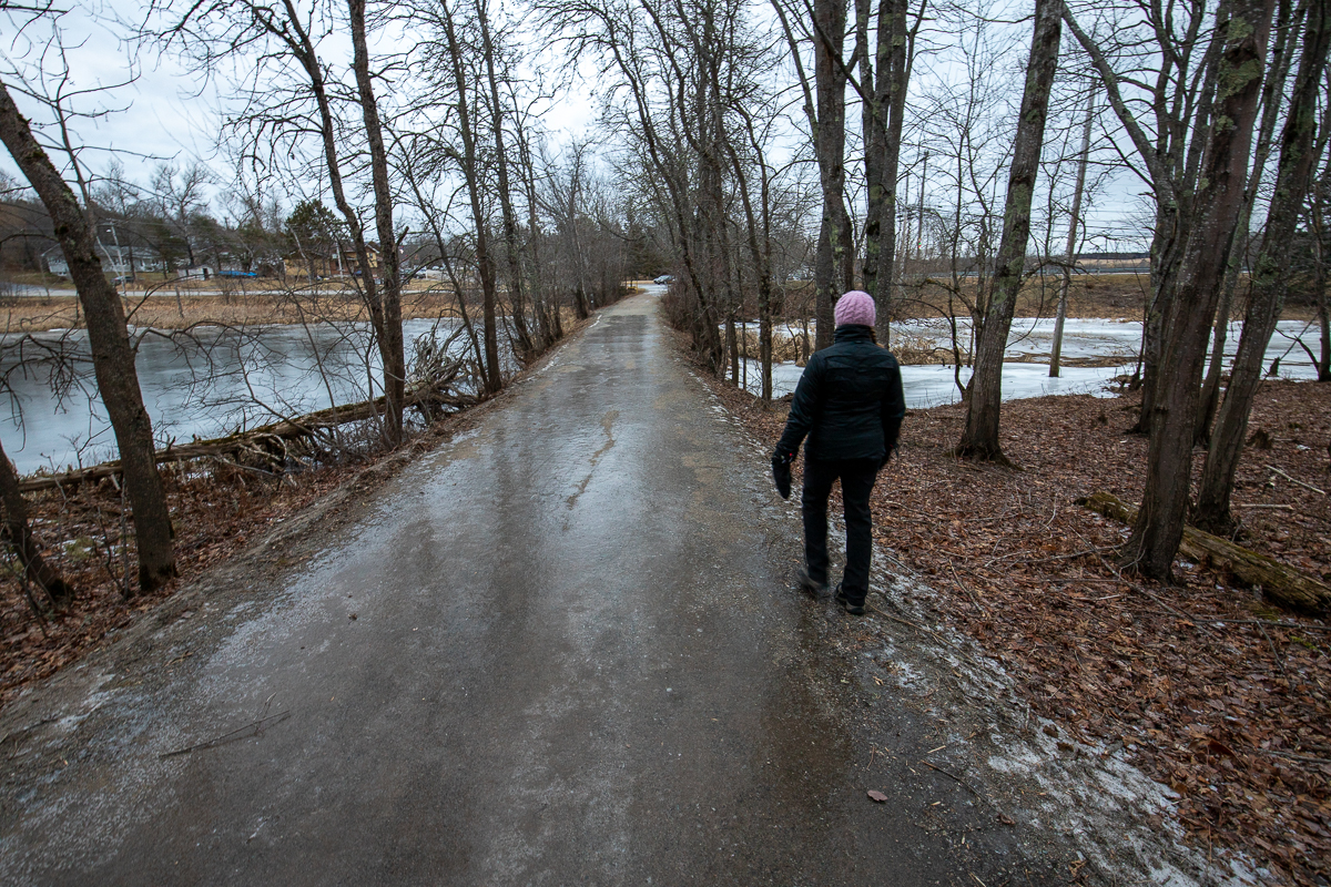
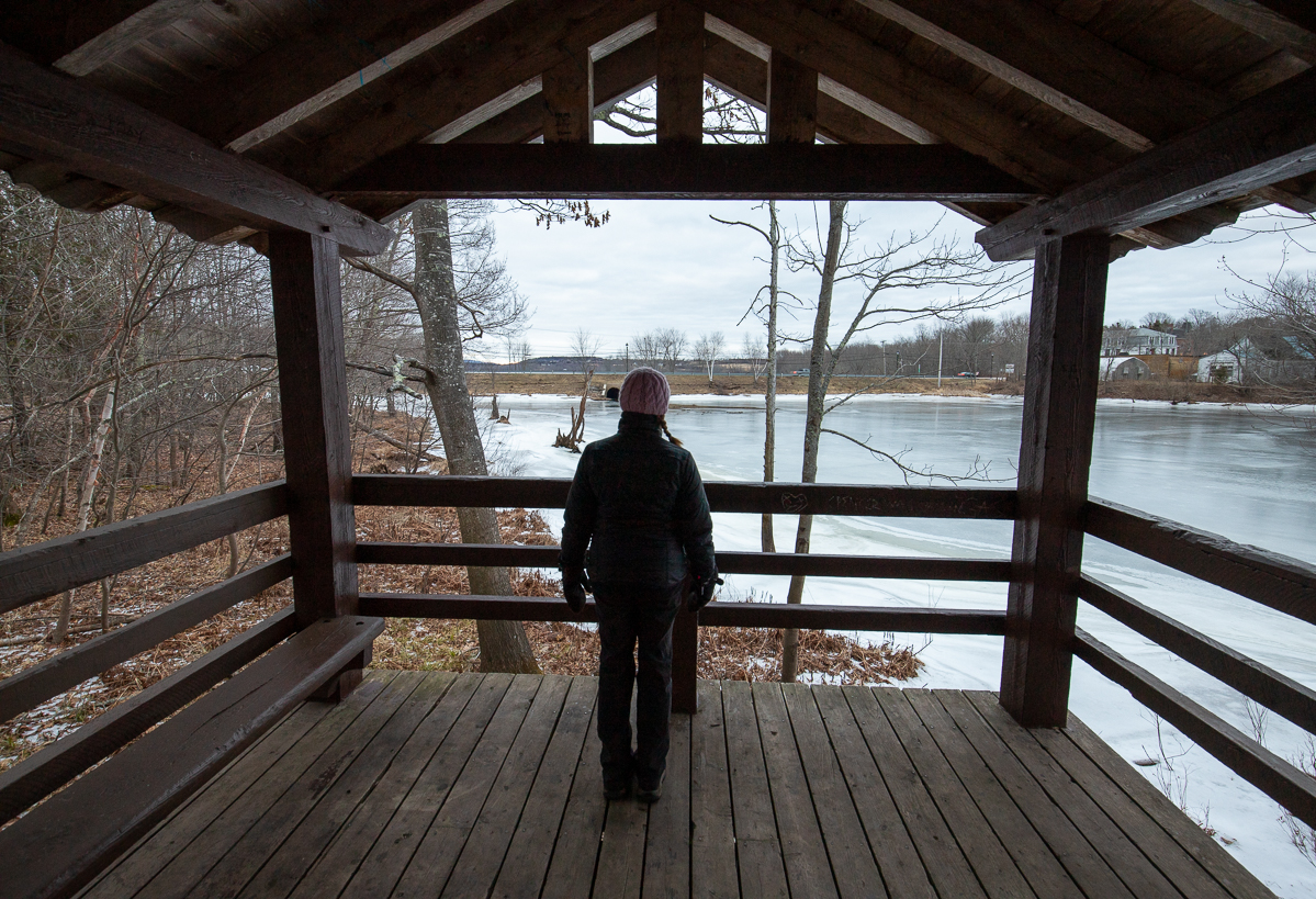
The wide, crushed rock trail starts at the main road and travels through the center of the small island. A smaller trail travels around the shores of the island. There is a large, elaborate lookout platform on one side of the island. To the south of the island are several sewage lagoons. The trail continues along the edge of the lagoons until it comes close to the main street in Hampton. There are several access trails to adjacent neighborhoods. The trail ends at the sports fields behind Hampton High School.
Map
Store


From the Sign
The History of Spooner Island
Maliseets are the first recorded people who lived, hunted and fished in this area. Their language gives us the words Ossekeag, meaning 'marshy brook', and Kennebecasis, meaning 'little snake'.
Acadians arrived in the early 1600s. They lived in peace with the aboriginal people, trading European goods for furs and sharing their knowledge of food and medicine.
When the Loyalists arrived in 1783, they took up land cultivated by the Acadians along the Kennebecasis. Spooner Island was part of a Loyalist land grant in 1784. The last family on the island was the Spooner family. Clarence Spooner published King's County Record.
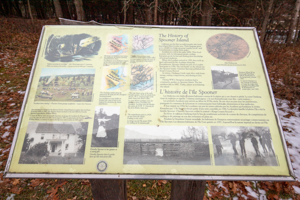
In winter, Ossekeag Creek came alive with horse racing, curling competitions, and skating to live music.
During WW2, Hampton residents had a community garden on Spooner Island. The last residents left in 1987. Today, nature is reclaiming the island.
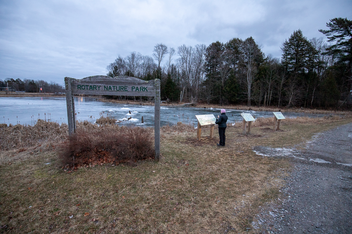
From the Sign
Marshes teem with life
Look and Listen. What plants and animals can you find in this marsh?
You may hear the red-winged blackbird's "kong-ka-ree", or the clear whistle of an osprey circling overhead, hunting for fish. Scan the water for jelly-like masses of toad eggs. Watch for tiny fish darting among the reeds.

Marshes are some of the most biologically diverse places on earth. Beaver, muskrat, shrews and voles feed and shelter here; gaspereau, yellow perch, eels, and amphibians use the marsh as a nursery. Damselflies, dragonflies and countless other insects live here too, above, below and on the water's surface.
In spring and fall, this marsh is an important resting and feeding place for migrating waterfowl shorebirds.
Marshes differ from other types of wetlands, like swamps, ponds, and ferns, because they undergo dramatic annual fluctuations in water levels. In spring they are flooded. By mid-summer they are dry. Marsh plants - cattails, grasses and sedges - have adapted to these changing conditions.
From the Sign
This Marsh is Important to You!
The Marsh in front of you is called Ossekeag Creek.
Ossekeag is part of an extensive wetland complex stretching from Perry Point and the Hammond River to Bloomfield, an area of approximately 2000 hectares located within the tributaries and backwaters of the Kennebecasis River.
Ossekeag water levels are influenced by tides from the Bay of Fundy, flowing up the Kennebecasis and Hammond Rivers.

How does the Ossekeag Creek wetland benefit the local environment?
- The wetland soaks up water like a giant sponge. During flooding it slows the damaging, erosive flow of water. During drought it stores precious water and helps maintain a high water table.
- Water in the creek slows down when it reaches the wetland. Suspended matter settles, and the water becomes clear.
- Ossekeag's aquatic plants actively filter out pesticides and heavy metals, giving us safe, clean drinking water.
- This wetland gives birds and mammals a home, and provides you with enjoyable wildlife-watching opportunities.
Directions
From Route 1 take exit 158 towards Hampton. After about a kilometre you will come to a stop sign on Main Street. Turn right and continue to the traffic circle near town hall. Go all the way around the traffic circle to the left and continue on Main Street. After 350 metres turn left onto Cemetery Road. You will see the start of the trail on your left just before turning in the road. Continue around a sharp turn and then turn into the first driveway. This is the parking area for the trails.
Other Trails in the area
Trail Last Hiked: December 29, 2019.
Page Last Updated: February 1, 2020.