Fundy Trail Provincial Park
Map
Galleries
Podcast
Episode 10: Spending the night at Seely Beach
Description
The Fundy Trail Provincial Park is on a rugged stretch of the Bay of Fundy coast. The park road travels along the hill tops overlooking the Bay of Fundy with many hairpin turns and lookouts on the way to the Big Salmon River. After Long Beach the road travels through the woods to the visitor centre and parking area at Walton Glen Gorge. After Walton Glen Gorge the road continues to Sackville or on to Fundy National Park.
The Fundy Trail Provincial Park is part of one of the longest stretches of remaining coastal wilderness areas between Florida and Labrador. A wide, crushed rock Multi Use Trail parallels the road for about 10 kilometres from the front gate to the Big Salmon River visitor centre. There are several side trails that explore historic cemeteries, flowerpot rock formations, waterfalls, gravel beaches, river valleys and more.
The Fundy Footpath is a long distance hiking trail that starts at the Big Salmon River Visitor Centre and travels for 48 kilometres to Point Wolfe in Fundy National Park.
The section of the park past Long Beach provides access to Long Beach Brook Falls, McLeod Brook Falls and the Walton Glen Gorge Lookout. Walton Glen Gorge is a deep gorge that cuts through the forest on the way to the Bay of Fundy. It has been called the Grand Canyon of New Brunswick. A 42 metre (126 foot) waterfall tumbles down the cliff face opposite the lookout. The lookout trail takes you out to an amazing lookout platform overlooking the gorge. If you are feeling more adventurous (and prepared), you can try to the Walton Glen Gorge Trail. This trail takes you down into the gorge.
Directions
From St. Martins travel east on Main Street for 2 km until you drop into a small valley and inlet. Keep right and Main Street will turn into Big Salmon River Road. Just around the turn you will cross a covered bridge over Vaughan Creek. After 3.7 km you will come to a fork in the road. Turn right at the fork onto Little Beach Road. Eventually Little Beach Road turns into Melvin Beach Road and after another 3.7 km you will come to the gate for the Fundy Trail Provincial Park.
From Sussex drive by Poley Mountain ski hill and follow the signs for the Fundy Trail Provincial Park, passing Adairs Wilderness Lodge at 12 kilometres. Continue past Adairs Wilderness Lodge for another 13 kilometres and you will come to the eastern gate.
From Fundy National Park's east gate, you can take the road just outside the gate on the left. Drive for about 15 kilometres and you will come to a stop sign. Turn left at the stop sign and drive for another 10 kilometres and you will come to the east gate of the Fundy Trail Provincial Park.
If the park is closed you can still access the Multi-Use Trail 500 meters before the gate on the right side of the road. You could probably also park at the gate and save yourself some time.
Trails in this Park
- Big Salmon River Beach Loop
- Big Salmon River Cemetery Footpath
- Bradshaw Lookout Scenic Footpath
- Cranberry Brook Loop
- Fuller Falls Trail
- Hearst Lodge Historic Footpath
- Long Beach Brook Waterfall Trail
- McCumber Brook Wetlands Trail
- McCumber Brook Access Trail to the Fundy Footpath
- McLeod Brook Falls Trail
- Melvin Beach Trail
- Multi Use Trail
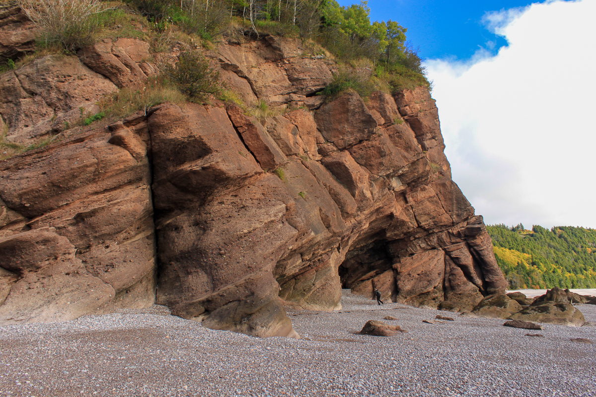
- Pot Rock Scenic Footpath
- Sea Captains' Burial Grounds Trail
- Seely Beach Access Trail
- Walton Glen Gorge Lookout Trail
- Walton Glen Gorge Trail


Store