Four Falls Trail
Gallery
Quick Facts
| Difficulty | easy |
| Trail Type | linear |
| Distance | 300 meters one way |
| Estimated Time | 20 mins return |
| Surface Type | old road, forested |
| Elevation Change | 33 meters |
| Features | waterfalls, old dam |
| Trail Markers | none but easy to follow |
| Scenery Rating | beautiful |
| Maintenance Rating | variable |
| Cell Reception | variable |
| Dog Friendly | yes |
| Fees | none |
Podcast
Episode 5: Leaving It All Behind at Four Falls
Description
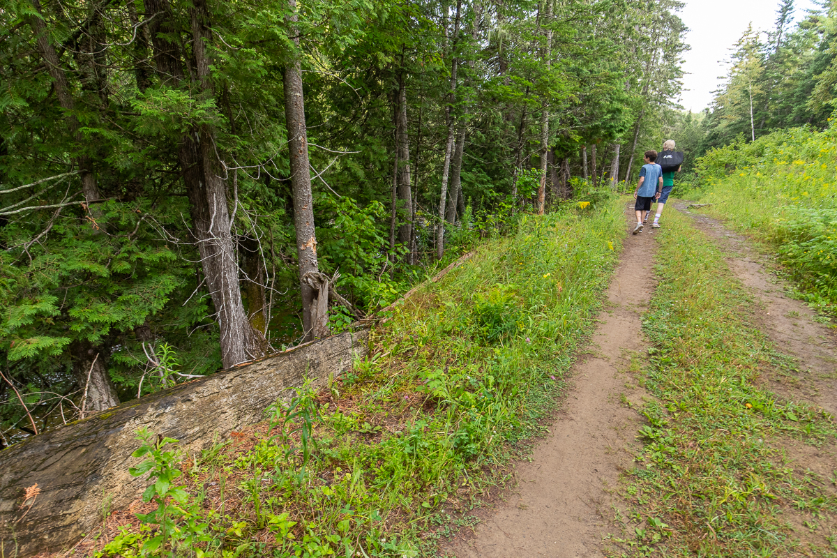
This is a short trail, and mostly an old road, but there is so much to explore in a small area. Follow the old road down the hill and you will get glimpses of small waterfalls in the stream below. The old road ends at the bottom of the hill. Taking the trails to the left will take you to the main falls. Continuing straight on another trail that enters the woods will take you down to the Aroostook River. There are also several side trails on the left that take you to the stream below the falls.
There is an old dry streambed between the main falls and the stream below that is interesting to explore. The mouth of this old streambed is plugged with large stumps and logs. The rocks in this area are extremely slippery. Probably the most slippery I have ever seen so use caution.

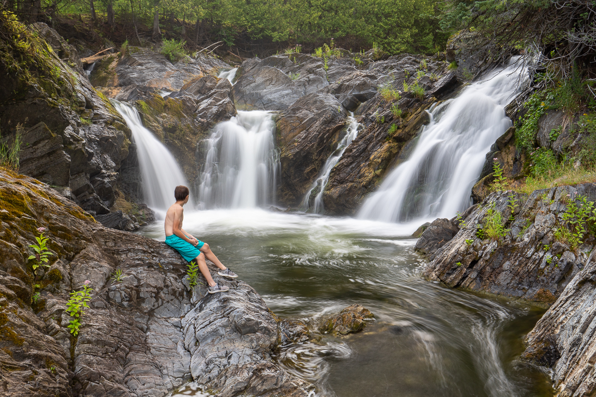
The main Four Falls Waterfall is probably a 20 foot high waterfall that splits into four streams as is passes through the rock face. The rock in this valley is mostly a flat angular rock that makes it a very interesting place to explore. You can climb a rock outcrop that is above the falls. Someone has put what we assume is a diving platform in the tree above this outcrop. The dive would be about a 30 foot drop into the pool below the falls. I would recommend not trying this jump unless you know the area. When we were swimming in the pool below the falls we found boulders just under the surface.
The deep pools below the falls are a great place to swim. When you get near the main falls the currents seem to push you in all different directions so use caution. Don't swim near the falls in the times of the year with strong water flow. If you are unsure start downstream and work your way up to the main pool.

Another interesting feature is the old crumbling dam above the bridge. Large chunks of the dam have broken away and lodged against a large rocky outcrop. Going out on the dam is dangerous. The surface is uneven and moss covered. If you look below the dam you will find that the cement is crumbling away quite dramatically.
Map
Store
Directions
Traveling north on Route 2 take exit 107 to Four Falls. At the stop sign turn left and go under the four lane highway and the old highway. Just after passing under the old highway turn left again and shortly after take another left to get onto the old highway. Cross the bridge and then at the first junction turn left onto No. 2 Old Rte 2. Just after this take one last left onto Brown Road. Drive down a small hill and cross a cement bridge. You can park along the road on the left just past this bridge.
If you are traveling south on Route 2 take exit 107 and then turn right. Just after that turn right again and you will turn onto the old highway. Cross the bridge and then at the first junction turn left onto No. 2 Old Rte 2. Right after this take one last left onto Brown Road. Drive down a small hill and cross a cement bridge. You can park along the road on the left just past this bridge.
The trail to the falls is an old road that travels down along the stream below the cement bridge. Across the road from the old road you will see a smaller trail enter the woods that accesses the crumbling dam above the bridge.

Trail Last Hiked: August 10, 2019.
Page Last Updated: August 11, 2019.